|
search place name
|
||
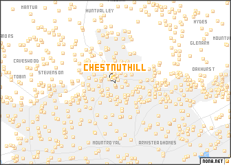
Chestnut Hill (Maryland, United States - USA)Chestnut Hill is a town in the Maryland region of United States - USA. An overview map of the region around Chestnut Hill is displayed below.
regional and 3d topo map of Chestnut Hill, United States - USA ::
Chestnut Hill airports ::
The nearest airport is BWI - Baltimore Washington Intl, located 25.9 km south of Chestnut Hill.
Other airports nearby include APG - Aberdeen Phillips Aaf (39.4 km east), ADW - Camp Springs Andrews Afb (Washington Dc Naf) (69.4 km south), DCA - Ronald Reagan Washington Natl (71.2 km south west), MDT - Harrisburg Intl (88.4 km north), Nearby towns ::
Marlywood (0.5km south) //
The Colony (0.4km north east) //
Burnbrae (0.7km south) //
Riderwood Hills (0.7km north) //
The Willows of Ruxton (0.9km north west) //
Devonshire Forest (1.1km north) //
Southland Hills (1.1km south east) //
Orchard Hills (1.4km north) //
Towson Park (1.3km east) //
Four Winds (1.5km south west) //
Green Ridge (1.7km north) //
Lutherville (1.8km north) //
Dulaney Village (1.7km north east) //
Ridervale (1.7km north west) //
Towson (1.6km east) //
Cloisters (2.1km south) //
Bridlewood (2.1km north) //
Murray Hill (2.1km south west) //
York Ridge (1.9km west) //
Ruxton Ridge (1.8km west) //
The Cloisters at Charles (2.4km south) //
Malvern (2.1km south west) //
Oak Hill (2.4km south west) //
Yorkleigh (2.4km south east) //
Shetland Hills (2.5km north east) //
Havenwood (2.7km north) //
Armagh (2.7km south) //
Country Club Park (2.6km north west) //
Lake (2.4km south west) //
[all distances 'as the bird flies' and approximate]  Places with similar names to Chestnut Hill, United States - USA ::
// Chestnut Hill (US)
// Chestnut Hill (US)
// Chestnut Hill (US)
// Chestnut Hill (US)
// Chestnut Hill (US)
// Chestnut Hill (US)
// Chestnut Hill (US)
// Chestnut Hill (US)
// Chestnut Hill (US)
// Chestnut Hill (US)
Disclaimer :: Information on this page comes without warranty of any kind |
||
|
Where is Chestnut Hill? Elevation and coordinates ::
Latitude (lat): 39°24'19"N Longitude (lon): 76°37'12"W
Elevation (approx.): 137m (map arrows pan, magnifying glasses zoom) |
||
|
Visiting Chestnut Hill? Hotel/Accommodation ::
Book a hotel in Chestnut Hill Travel Guide ::
rental cars ::
car rental offers GPS waypoint ::
download a GPX waypoint (PoI) of Chestnut Hill for your GPS receiver
|
||