|
search place name
|
||
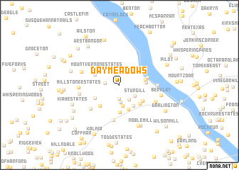
Day Meadows (Maryland, United States - USA)Day Meadows is a town in the Maryland region of United States - USA. An overview map of the region around Day Meadows is displayed below.
regional and 3d topo map of Day Meadows, United States - USA ::
Day Meadows airports ::
The nearest airport is APG - Aberdeen Phillips Aaf, located 24.8 km south of Day Meadows.
Other airports nearby include ILG - Wilmington New Castle (56.8 km east), BWI - Baltimore Washington Intl (65.3 km south west), MDT - Harrisburg Intl (71.4 km north west), MUI - Muir Aaf (88.1 km north), Nearby towns ::
Deerfield (2.1km south) //
Macton (1.8km west) //
Dublin (2.8km south) //
Rock Manor (2.6km south east) //
Sturgill (2.5km south east) //
Cooper (2.9km north west) //
Dublin Manor (3.3km south) //
Gladstone Acres (3.7km south east) //
Broad Creek Park (3.4km north east) //
Poole (4.0km south) //
Millers Store (3.3km east) //
Prospect (3.4km north west) //
Lafayettes Crossing (3.3km east) //
Poplar Grove (4.3km south) //
Halls Trailer Villa (3.8km south east) //
Gallions Corner (3.7km south east) //
Mill Green Acres (3.6km south west) //
Mount Vernon Estates (3.7km north west) //
Scarboro (4.0km south west) //
Bald Hill (3.6km east) //
McCanns Corner (5.5km south) //
Deer Park (5.1km south west) //
Castleton (4.6km east) //
Hopkins Corner (5.1km south east) //
Spring House Estates (5.0km north west) //
Mill Stone Estates (5.0km west) //
Mill Green (5.1km west) //
Berkley (5.3km east) //
Nobles Mill Estates (6.8km south) //
[all distances 'as the bird flies' and approximate]  Places with similar names to Day Meadows, United States - USA ::
Disclaimer :: Information on this page comes without warranty of any kind |
||
|
Where is Day Meadows? Elevation and coordinates ::
Latitude (lat): 39°40'32"N Longitude (lon): 76°16'6"W
Elevation (approx.): 127m (map arrows pan, magnifying glasses zoom) |
||
|
Visiting Day Meadows? Hotel/Accommodation ::
Book a hotel in Day Meadows Travel Guide ::
rental cars ::
car rental offers GPS waypoint ::
download a GPX waypoint (PoI) of Day Meadows for your GPS receiver
|
||