|
search place name
|
||
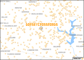
Dorsey Crossroads (Maryland, United States - USA)Dorsey Crossroads is a town in the Maryland region of United States - USA. An overview map of the region around Dorsey Crossroads is displayed below.
regional and 3d topo map of Dorsey Crossroads, United States - USA ::
Dorsey Crossroads airports ::
The nearest airport is BWI - Baltimore Washington Intl, located 40.7 km south east of Dorsey Crossroads.
Other airports nearby include DCA - Ronald Reagan Washington Natl (64.1 km south), IAD - Washington Dulles Intl (66.3 km south west), ADW - Camp Springs Andrews Afb (Washington Dc Naf) (69.7 km south), APG - Aberdeen Phillips Aaf (72.4 km east), Nearby towns ::
Equestrian Estates (0.3km west) //
Piney Run Estates (0.6km south) //
Bushey Heights (1.1km north west) //
Buckhorn Run (1.4km south west) //
Heather Ridge (1.8km south west) //
Wilson Terrace (1.6km north east) //
Heritage (2.2km north) //
Benders Heights (2.3km north) //
Chestnut Oaks (2.0km south west) //
Streamwood (2.3km south west) //
Arthur Ridge (2.2km south west) //
Barrett (2.5km south) //
Brass Eagle Estates (2.7km south) //
Shawns Landing (2.8km south) //
Red Fox Meadow (2.2km west) //
Monks Misery (2.8km south) //
Bar-Klee Estates (2.8km north) //
Blankner Hill (2.8km south) //
Carroll Park (2.9km north) //
Dogwood Estates (3.0km south) //
Sunset Hill (2.8km north east) //
Linton Springs (2.4km east) //
Knollers Woods (2.4km east) //
Gist (2.8km north east) //
Wild Lake Estates (3.2km south) //
Daisy Meadows (3.3km south) //
South Carroll Estates (2.9km south west) //
Presidential Park (3.3km north east) //
Parkside (2.7km east) //
[all distances 'as the bird flies' and approximate]  Places with similar names to Dorsey Crossroads, United States - USA :: Disclaimer :: Information on this page comes without warranty of any kind |
||
|
Where is Dorsey Crossroads? Elevation and coordinates ::
Latitude (lat): 39°25'45"N Longitude (lon): 77°0'29"W
Elevation (approx.): 215m (map arrows pan, magnifying glasses zoom) |
||
|
Visiting Dorsey Crossroads? Hotel/Accommodation ::
Book a hotel in Dorsey Crossroads Travel Guide ::
rental cars ::
car rental offers GPS waypoint ::
download a GPX waypoint (PoI) of Dorsey Crossroads for your GPS receiver
|
||