|
search place name
|
||
Ivory (Maryland, United States - USA)Ivory is a town in the Maryland region of United States - USA. An overview map of the region around Ivory is displayed below.
regional and 3d topo map of Ivory, United States - USA ::

Ivory airports ::
The nearest airport is BWI - Baltimore Washington Intl, located 29.3 km south east of Ivory.
Other airports nearby include DCA - Ronald Reagan Washington Natl (48.1 km south), ADW - Camp Springs Andrews Afb (Washington Dc Naf) (53.3 km south), IAD - Washington Dulles Intl (55.8 km south west), APG - Aberdeen Phillips Aaf (72.7 km east), Nearby towns ::
Eagles Loft (1.3km south east) //
Kingston (1.5km south east) //
The Corners (2.0km south) //
Shepherds Glen (2.0km south) //
Sycamore Springs (1.7km south east) //
Burnt Woods (1.7km west) //
Rose Mary Estates (1.7km east) //
Gwenlee Estates (2.0km west) //
Glenelg (2.4km south west) //
Rover Mill Estates (2.3km north west) //
Wayside Estates (2.4km south east) //
Brantly (2.5km west) //
Benson (2.6km east) //
Buckskin Woods (3.2km south) //
Buttercup Estates (3.0km north east) //
Oakwood Overlook (3.6km south) //
West Friendship (3.1km north east) //
Friendship Manor (3.2km north east) //
Fox Den Farms (3.3km south east) //
Glenwood Estates (3.2km west) //
The Heritage (3.6km south west) //
Gary (3.6km south west) //
Briar Hill (3.4km east) //
Wynfield (3.5km north east) //
Dill (3.6km south west) //
Heatherwood (4.5km north) //
Annandale (4.6km north) //
Green Meadows (3.5km west) //
Dayton (4.9km south) //
[all distances 'as the bird flies' and approximate] 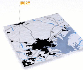 Places with similar names to Ivory, United States - USA ::
Disclaimer :: Information on this page comes without warranty of any kind |
||
|
Where is Ivory? Elevation and coordinates ::
Latitude (lat): 39°16'57"N Longitude (lon): 76°58'44"W
Elevation (approx.): 176m (map arrows pan, magnifying glasses zoom) |
||
|
Visiting Ivory? Hotel/Accommodation ::
Book a hotel in Ivory Travel Guide ::
rental cars ::
car rental offers GPS waypoint ::
download a GPX waypoint (PoI) of Ivory for your GPS receiver
|
||