|
search place name
|
||
Leahigh (Maryland, United States - USA)Leahigh is a town in the Maryland region of United States - USA. An overview map of the region around Leahigh is displayed below.
regional and 3d topo map of Leahigh, United States - USA ::

Leahigh airports ::
The nearest airport is BWI - Baltimore Washington Intl, located 19.2 km south of Leahigh.
Other airports nearby include APG - Aberdeen Phillips Aaf (47.2 km east), ADW - Camp Springs Andrews Afb (Washington Dc Naf) (61.4 km south), DCA - Ronald Reagan Washington Natl (62.4 km south west), IAD - Washington Dulles Intl (79.5 km south west), Nearby towns ::
Glenmore Park (0.8km east) //
West Arlington (1.1km south) //
Euclid Heights (1.1km north east) //
Mount Hope (1.0km north west) //
Arlington (1.2km south east) //
Brighton (1.2km north west) //
Gwynn Oak (1.6km south) //
Howard Park (1.8km south) //
Cheswolde (1.9km north) //
Colonial Village (2.0km north west) //
West Forest Park (2.4km south) //
Denmore Park (2.0km east) //
Forest Park (2.6km south east) //
Fallstaff (2.6km north west) //
Pimlico (2.2km east) //
Haywood Heights (2.4km south west) //
Mount Washington (2.7km north east) //
Pickwick (3.1km north) //
Lochearn (2.5km west) //
Hillsdale Green (3.1km south) //
Dickeyville (3.2km south) //
Wellwood (3.3km north) //
Valley Stream (3.4km north) //
Howardsville (3.0km north west) //
Powhatan Hill (3.3km south west) //
Wetheredsville (3.6km south) //
Summit Park (3.7km north) //
Wakefield (3.8km south) //
Ranchleigh (3.6km north east) //
[all distances 'as the bird flies' and approximate] 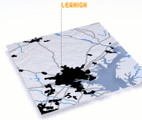 Places with similar names to Leahigh, United States - USA ::
Disclaimer :: Information on this page comes without warranty of any kind |
||
|
Where is Leahigh? Elevation and coordinates ::
Latitude (lat): 39°20'49"N Longitude (lon): 76°41'40"W
Elevation (approx.): 127m (map arrows pan, magnifying glasses zoom) |
||
|
Visiting Leahigh? Hotel/Accommodation ::
Book a hotel in Leahigh Travel Guide ::
rental cars ::
car rental offers GPS waypoint ::
download a GPX waypoint (PoI) of Leahigh for your GPS receiver
|
||