|
search place name
|
||
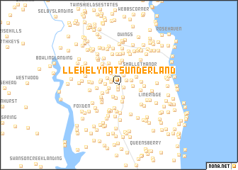
Llewelyn at Sunderland (Maryland, United States - USA)Llewelyn at Sunderland is a town in the Maryland region of United States - USA. An overview map of the region around Llewelyn at Sunderland is displayed below.
regional and 3d topo map of Llewelyn at Sunderland, United States - USA ::
Llewelyn at Sunderland airports ::
The nearest airport is ADW - Camp Springs Andrews Afb (Washington Dc Naf), located 28.4 km north west of Llewelyn at Sunderland.
Other airports nearby include DCA - Ronald Reagan Washington Natl (43.2 km north west), NHK - Patuxent River Nas (44.3 km south east), BWI - Baltimore Washington Intl (58.1 km north), IAD - Washington Dulles Intl (80.3 km north west), Nearby towns ::
Twin Lakes (0.3km south) //
Sunderland Park (0.7km south) //
Brighton Woods (0.6km south east) //
Marlboro Hills (1.0km north) //
Lower Marlboro Meadow (1.1km north west) //
April Estates (1.2km north west) //
Federal Oak Estates (1.2km north east) //
Camelback (1.5km north west) //
Sleepy Hollow (1.3km south west) //
Pleasant Valley (1.6km north) //
Den Mar (1.9km north) //
Green Meadows (2.0km south) //
Sheckells Hills (2.0km south) //
Carriage Hills (2.1km south) //
Musgrove Estates (1.8km south west) //
Kwanson Acres (1.7km north east) //
Sunderland Woods (1.7km west) //
Sunshine Acres (1.8km north west) //
Sunderland Estates (1.7km east) //
Lord Calvert Hills (2.1km north west) //
Sunderland (2.2km north east) //
Persimmon Hills (2.5km north) //
Sunderland Farms (2.5km north west) //
Sandy Bottom (2.7km south) //
Huntingtown Farms (2.4km south west) //
Breezy Knoll Estates (2.3km west) //
Briarwood (2.3km west) //
Ireland Estates (2.5km north east) //
Stone Farm (3.0km south west) //
[all distances 'as the bird flies' and approximate]  Places with similar names to Llewelyn at Sunderland, United States - USA :: Disclaimer :: Information on this page comes without warranty of any kind |
||
|
Where is Llewelyn at Sunderland? Elevation and coordinates ::
Latitude (lat): 38°39'14"N Longitude (lon): 76°36'35"W
Elevation (approx.): 39m (map arrows pan, magnifying glasses zoom) |
||
|
Visiting Llewelyn at Sunderland? Hotel/Accommodation ::
Book a hotel in Llewelyn at Sunderland Travel Guide ::
rental cars ::
car rental offers GPS waypoint ::
download a GPX waypoint (PoI) of Llewelyn at Sunderland for your GPS receiver
|
||