|
search place name
|
||
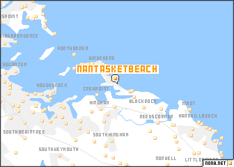
Nantasket Beach (Massachusetts, United States - USA)Nantasket Beach is a town in the Massachusetts region of United States - USA. An overview map of the region around Nantasket Beach is displayed below.
regional and 3d topo map of Nantasket Beach, United States - USA ::
nearby GPS traces from timatio ::
Nantasket Beach airports ::
The nearest airport is BOS - Boston General Edward Lawrence Logan Intl, located 14.9 km north west of Nantasket Beach.
Other airports nearby include BED - Bedford Laurence G Hanscom Fld (40.8 km north west), PVD - Providence Theodore Francis Green State (76.0 km south west), ACK - Nantucket Mem (132.1 km south east), CEF - Chicopee Falls Westover Arb Metropolitan (138.0 km west), Nearby towns ::
Kenberma (0.9km north west) //
Waveland (1.9km north west) //
Atlantic (1.9km south east) //
Straits Pond (2.0km south east) //
Bayside (2.8km north west) //
North Cohasset (2.9km south east) //
Allerton (3.3km north west) //
Nantasket Junction (3.7km south) //
Crow Point (3.0km south west) //
Windemere (3.6km north west) //
Fort Duvall (3.5km north west) //
Hingham (4.5km south west) //
Stony Beach (4.4km north west) //
Hingham Center (5.1km south) //
Hull (4.4km north west) //
Fort Revere (4.7km north west) //
Black Rock (4.9km south east) //
West Hingham (5.4km south west) //
Fort Hill (5.4km south west) //
Cole Corner (6.2km south) //
Pemberton (5.2km north west) //
Fort Andrews (5.7km north west) //
Cohasset (6.5km south east) //
Fort Warren (6.9km north west) //
Lincoln Heights (7.4km south west) //
Tuttleville (8.4km south west) //
Reeds Corner (7.9km south east) //
Beechwood (8.5km south east) //
East Weymouth (8.4km south west) //
[all distances 'as the bird flies' and approximate]  Places with similar names to Nantasket Beach, United States - USA :: Disclaimer :: Information on this page comes without warranty of any kind |
||
|
Where is Nantasket Beach? Elevation and coordinates ::
Latitude (lat): 42°16'40"N Longitude (lon): 70°52'0"W
Elevation (approx.): 11m (map arrows pan, magnifying glasses zoom) |
||
|
Visiting Nantasket Beach? Hotel/Accommodation ::
Book a hotel in Nantasket Beach Travel Guide ::
rental cars ::
car rental offers GPS waypoint ::
download a GPX waypoint (PoI) of Nantasket Beach for your GPS receiver
|
||