|
search place name
|
||
Pontoosuc (Massachusetts, United States - USA)Pontoosuc is a town in the Massachusetts region of United States - USA. An overview map of the region around Pontoosuc is displayed below.
regional and 3d topo map of Pontoosuc, United States - USA ::

Pontoosuc airports ::
The nearest airport is ALB - Albany Intl, located 54.5 km north west of Pontoosuc.
Other airports nearby include CEF - Chicopee Falls Westover Arb Metropolitan (66.6 km south east), BDL - Windsor Locks Bradley Intl (75.9 km south east), HFD - Hartford Brainard (96.1 km south east), SWF - Newburgh Stewart Intl (129.6 km south west), Nearby towns ::
Camp Sumner (1.0km north) //
Camp Merrill (1.1km north) //
Lakeview Terrace (1.5km north) //
Pontoosuc Gardens (1.8km north) //
Victory Hill (1.7km south east) //
Pittsfield (3.2km south) //
Lakewood (3.7km south east) //
Camp Stevenson (3.1km west) //
Camp Witawentin (3.4km west) //
Lanesborough (4.5km north) //
Adams Junction (3.9km south east) //
Coltsville (3.7km east) //
The Boulders (3.7km east) //
Yankee Orchards (5.0km south east) //
Berkshire (5.7km north east) //
Green Ridge Park (5.6km south east) //
Greylock Estates (7.1km north) //
Stearnsville (6.2km south west) //
Camp Mohawk (7.1km north east) //
Dalton (6.5km east) //
West Pittsfield (7.5km south west) //
Barkerville (8.2km south west) //
Farnams (8.5km north east) //
Camp Marion White (9.2km south west) //
Hancock (9.6km north west) //
Camp Russell (9.9km south west) //
[all distances 'as the bird flies' and approximate] 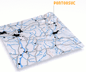 Places with similar names to Pontoosuc, United States - USA ::
// Ponta Sêca (BR)
// Pontoosuc (US)
// Pintsch (LU)
// Ponte Seca (PT)
// Pentiškiai (LT)
// Pantošić (BA)
// Punta Seca (CO)
// Pian di Scò (IT)
// Poniatowski (US)
// Ponta Isaac (GW)
Disclaimer :: Information on this page comes without warranty of any kind |
||
|
Where is Pontoosuc? Elevation and coordinates ::
Latitude (lat): 42°28'45"N Longitude (lon): 73°14'45"W
Elevation (approx.): 331m (map arrows pan, magnifying glasses zoom) |
||
|
Visiting Pontoosuc? Hotel/Accommodation ::
Book a hotel in Pontoosuc Travel Guide ::
rental cars ::
car rental offers GPS waypoint ::
download a GPX waypoint (PoI) of Pontoosuc for your GPS receiver
|
||