|
search place name
|
||
Lobdell (Mississippi, United States - USA)Lobdell is a town in the Mississippi region of United States - USA. An overview map of the region around Lobdell is displayed below.
regional and 3d topo map of Lobdell, United States - USA ::

Lobdell airports ::
The nearest airport is GWO - Greenwood Leflore, located 86.9 km east of Lobdell.
Other airports nearby include LIT - Little Rock Adams Fld (160.2 km north west), MLU - Monroe Rgnl (166.2 km south west), LRF - Jacksonville Little Rock Afb (171.0 km north west), MEM - Memphis Intl (173.6 km north east), Nearby towns ::
Dahomy (4.9km south) //
Niblett Landing (5.4km west) //
Christmas (6.5km north) //
Beulah (7.6km north) //
Benoit (7.9km south) //
Bolivar Landing (8.8km south west) //
Mound City (9.2km north east) //
Bolivar (9.2km south west) //
Longshot (11.0km south east) //
[all distances 'as the bird flies' and approximate] 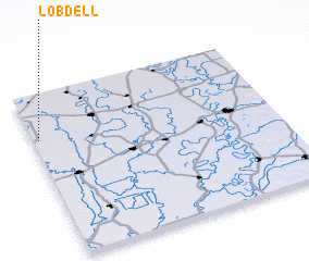 Places with similar names to Lobdell, United States - USA ::
// Lobetal (DE)
// La Obdulia (CU)
// La Abadilla (ES)
// Lobdell (US)
// Labutali (BD)
// Lebutala (BD)
// La Batalla (CO)
// La Batalla (CO)
// La Batalla (CO)
// La Betulia (CO)
Disclaimer :: Information on this page comes without warranty of any kind |
||
|
Where is Lobdell? Elevation and coordinates ::
Latitude (lat): 33°43'6"N Longitude (lon): 90°58'56"W
Elevation (approx.): 43m (map arrows pan, magnifying glasses zoom) |
||
|
Visiting Lobdell? Hotel/Accommodation ::
Book a hotel in Lobdell Travel Guide ::
rental cars ::
car rental offers GPS waypoint ::
download a GPX waypoint (PoI) of Lobdell for your GPS receiver
|
||