|
search place name
|
||
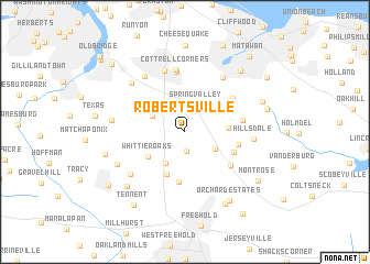
Robertsville (New Jersey, United States - USA)Robertsville is a town in the New Jersey region of United States - USA. An overview map of the region around Robertsville is displayed below.
regional and 3d topo map of Robertsville, United States - USA ::
Robertsville airports ::
The nearest airport is NEL - Lakehurst Naes, located 35.2 km south of Robertsville.
Other airports nearby include EWR - Newark Liberty Intl (39.8 km north), WRI - Wrightstown Mc Guire Afb (44.9 km south west), TTN - Trenton Mercer (45.3 km west), JFK - New York John F Kennedy Intl (54.1 km north east), Nearby towns ::
Claytons Corner (1.9km south) //
Spring Valley (2.9km north) //
Herberts Corner (2.9km south east) //
Moerls Corner (3.0km north west) //
Gordons Corner (3.5km south west) //
Wickatunk (3.4km east) //
Whittier Oaks (3.8km south west) //
Lafayette Mills (4.5km south) //
Monmouth Heights at Manalapan (5.1km south) //
Monmouth Heights at Marlboro (4.3km south east) //
Bradevelt (4.3km east) //
Marlboro (4.9km south east) //
Morganville (5.0km north east) //
Smocks Corners (4.6km east) //
Brownville (6.1km north) //
Cottrell Corners (6.4km north) //
Browntown (6.4km north) //
Henningers Mill (6.2km north east) //
Yorketown (6.0km south west) //
Sayerwood South (6.5km north west) //
Hillsdale (5.4km east) //
Brunswick Gardens (6.4km north west) //
Redshaw Corner (5.8km west) //
Clarks Mills (6.2km south west) //
Taylors Mills (7.1km south west) //
East Freehold (7.9km south east) //
Freneau (7.5km north east) //
Orchard Estates (7.8km south east) //
Mounts Mills (6.6km west) //
[all distances 'as the bird flies' and approximate]  Places with similar names to Robertsville, United States - USA ::
// Robertsville (US)
// Robertsville (US)
// Robertsville (US)
// Robertsville (US)
// Robertsvlei (ZA)
// Robertsville (US)
// Robertsville (US)
// Robertsville (US)
// Robertsville (US)
// Robertsville (LR)
Disclaimer :: Information on this page comes without warranty of any kind |
||
|
Where is Robertsville? Elevation and coordinates ::
Latitude (lat): 40°20'46"N Longitude (lon): 74°17'18"W
Elevation (approx.): 56m (map arrows pan, magnifying glasses zoom) |
||
|
Visiting Robertsville? Hotel/Accommodation ::
Book a hotel in Robertsville Travel Guide ::
rental cars ::
car rental offers GPS waypoint ::
download a GPX waypoint (PoI) of Robertsville for your GPS receiver
|
||