|
search place name
|
||
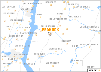
Red Hook (New York, United States - USA)Red Hook is a town in the New York region of United States - USA. An overview map of the region around Red Hook is displayed below.
regional and 3d topo map of Red Hook, United States - USA ::
Red Hook airports ::
The nearest airport is SWF - Newburgh Stewart Intl, located 57.8 km south of Red Hook.
Other airports nearby include ALB - Albany Intl (83.9 km north), BDL - Windsor Locks Bradley Intl (99.1 km east), HPN - White Plains Westchester Co (104.0 km south), HFD - Hartford Brainard (105.8 km east), Nearby towns ::
Red Hook Mills (1.7km north) //
Linden Acres (1.9km north) //
College Park (2.7km north) //
Annandale-on-Hudson (3.4km north west) //
Fraleighs (3.5km east) //
Upper Red Hook (4.6km north east) //
Barrytown (4.0km west) //
Eighmyville (5.9km south) //
Kerleys Corners (5.8km north east) //
Cokertown (5.2km north east) //
Rock City (5.3km south east) //
Tivoli (7.6km north) //
Ulster Landing (6.0km west) //
Nevis (7.8km north) //
Rhinebeck (8.2km south) //
Glasco (8.0km north west) //
Rhinecliff (10.5km south west) //
[all distances 'as the bird flies' and approximate]  Places with similar names to Red Hook, United States - USA ::
// Red Hook (US)
Disclaimer :: Information on this page comes without warranty of any kind |
||
|
Where is Red Hook? Elevation and coordinates ::
Latitude (lat): 41°59'42"N Longitude (lon): 73°52'33"W
Elevation (approx.): 68m (map arrows pan, magnifying glasses zoom) |
||
|
Visiting Red Hook? Hotel/Accommodation ::
Book a hotel in Red Hook Travel Guide ::
rental cars ::
car rental offers GPS waypoint ::
download a GPX waypoint (PoI) of Red Hook for your GPS receiver
|
||