|
search place name
|
||
Mount Sterling (North Carolina, United States - USA)Mount Sterling is a town in the North Carolina region of United States - USA. An overview map of the region around Mount Sterling is displayed below.
regional and 3d topo map of Mount Sterling, United States - USA ::

Mount Sterling airports ::
The nearest airport is TYS - Knoxville Mc Ghee Tyson, located 80.7 km west of Mount Sterling.
Other airports nearby include AND - Andersen Anderson Rgnl (145.1 km south), HKY - Hickory Rgnl (155.1 km east), MGE - Marietta Dobbins Arb (Atlanta Nas) (242.2 km south west), CAE - Colombia Columbia Metropolitan (271.7 km south east), Nearby towns ::
Waterville (1.1km north) //
Crestmont (1.2km south west) //
Browns (2.7km north) //
Grassy Fork (6.2km north) //
Hartford (7.0km north west) //
Bluffton (8.4km north west) //
[all distances 'as the bird flies' and approximate] 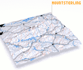 Places with similar names to Mount Sterling, United States - USA ::
// Mount Sterling (US)
// Mount Sterling (US)
// Mount Sterling (US)
// Mount Sterling (US)
// Mount Sterling (US)
// Mount Sterling (US)
// Mount Sterling (US)
// Mount Sterling (US)
// Mount Sterling (US)
// Mount Sterling (US)
Disclaimer :: Information on this page comes without warranty of any kind |
||
|
Where is Mount Sterling? Elevation and coordinates ::
Latitude (lat): 35°45'43"N Longitude (lon): 83°6'14"W
Elevation (approx.): 483m (map arrows pan, magnifying glasses zoom) |
||
|
Visiting Mount Sterling? Hotel/Accommodation ::
Book a hotel in Mount Sterling Travel Guide ::
rental cars ::
car rental offers GPS waypoint ::
download a GPX waypoint (PoI) of Mount Sterling for your GPS receiver
|
||