|
search place name
|
||
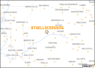
Atwells Crossing (Pennsylvania, United States - USA)Atwells Crossing is a town in the Pennsylvania region of United States - USA. An overview map of the region around Atwells Crossing is displayed below.
regional and 3d topo map of Atwells Crossing, United States - USA ::
Atwells Crossing airports ::
The nearest airport is YNG - Youngstown Warren Rgnl, located 66.0 km west of Atwells Crossing.
Other airports nearby include PIT - Pittsburgh (pennsylva) Pittsburgh Intl (73.1 km south), AKR - Akron Fulton Intl (130.2 km west), AOO - Altoona Blair Co (162.4 km south east), CLE - Cleveland Hopkins Intl (165.2 km west), Nearby towns ::
Boyers (1.8km east) //
Annandale (2.8km south east) //
Deegan (4.1km north east) //
Moniteau (5.0km south) //
Keenan (4.0km east) //
Murrinsville (5.2km north east) //
Five Points (6.5km south) //
Ferris (5.0km east) //
Bovard (5.5km south west) //
Branchton (6.6km south west) //
Whiskerville (6.6km south east) //
Wick (6.3km west) //
Higgins Corner (6.6km east) //
Coaltown (8.0km south west) //
Kohlmeyer Corner (7.6km north east) //
Smith Corners (9.5km north east) //
[all distances 'as the bird flies' and approximate]  Places with similar names to Atwells Crossing, United States - USA :: Disclaimer :: Information on this page comes without warranty of any kind |
||
|
Where is Atwells Crossing? Elevation and coordinates ::
Latitude (lat): 41°6'18"N Longitude (lon): 79°55'14"W
Elevation (approx.): 363m (map arrows pan, magnifying glasses zoom) |
||
|
Visiting Atwells Crossing? Hotel/Accommodation ::
Book a hotel in Atwells Crossing Travel Guide ::
rental cars ::
car rental offers GPS waypoint ::
download a GPX waypoint (PoI) of Atwells Crossing for your GPS receiver
|
||