|
search place name
|
||
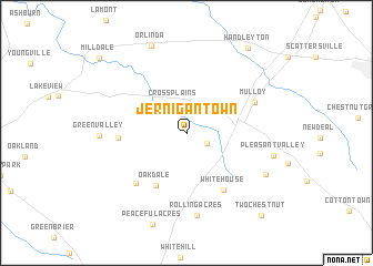
Jernigan Town (Tennessee, United States - USA)Jernigan Town is a town in the Tennessee region of United States - USA. An overview map of the region around Jernigan Town is displayed below.
regional and 3d topo map of Jernigan Town, United States - USA ::
Jernigan Town airports ::
The nearest airport is BNA - Nashville Intl, located 44.1 km south of Jernigan Town.
Other airports nearby include HOP - Hopkinsville Campbell Aaf (74.4 km west), FTK - Fort Knox Godman Aaf (166.2 km north), HUA - Redstone Aaf (204.5 km south), LOU - Louisville Bowman Fld (209.8 km north east), Nearby towns ::
Calistia (2.0km south east) //
Cross Plains (3.1km north) //
Oakdale (5.8km south west) //
Eden Corner (5.5km west) //
White House (6.5km south east) //
Baggettsville (6.5km south west) //
Mulloy (6.3km north east) //
Rolling Acres (8.4km south) //
Green Valley (7.1km west) //
Pleasant Valley (7.4km east) //
Walnut Grove (7.7km south east) //
Orlinda (9.2km north) //
Handleyton (9.9km north east) //
Two Chestnut (10.3km south east) //
Milldale (10.3km north west) //
[all distances 'as the bird flies' and approximate]  Places with similar names to Jernigan Town, United States - USA :: Disclaimer :: Information on this page comes without warranty of any kind |
||
|
Where is Jernigan Town? Elevation and coordinates ::
Latitude (lat): 36°31'20"N Longitude (lon): 86°41'5"W
Elevation (approx.): 225m (map arrows pan, magnifying glasses zoom) |
||
|
Visiting Jernigan Town? Hotel/Accommodation ::
Book a hotel in Jernigan Town Travel Guide ::
rental cars ::
car rental offers GPS waypoint ::
download a GPX waypoint (PoI) of Jernigan Town for your GPS receiver
|
||