|
search place name
|
||
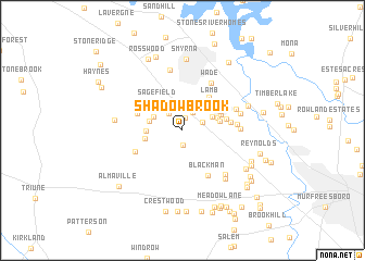
Shadowbrook (Tennessee, United States - USA)Shadowbrook is a town in the Tennessee region of United States - USA. An overview map of the region around Shadowbrook is displayed below.
regional and 3d topo map of Shadowbrook, United States - USA ::
nearby GPS traces from timatio ::
Shadowbrook airports ::
The nearest airport is BNA - Nashville Intl, located 27.0 km north west of Shadowbrook.
Other airports nearby include HOP - Hopkinsville Campbell Aaf (120.9 km north west), HUA - Redstone Aaf (138.1 km south), CHA - Chattanooga Lovell Fld (154.5 km south east), FTK - Fort Knox Godman Aaf (226.3 km north), Nearby towns ::
McAndore Estates (0.7km north) //
Aberdeen Park (1.3km north) //
Little Hope (1.5km south) //
Glenrose Park (2.0km north east) //
Marathon Trail (1.8km north east) //
Quail Ridge (2.0km north west) //
Neal Circle (2.7km north west) //
Joywood (2.9km north east) //
Foxland Forest (2.9km west) //
Sagefield (3.4km north west) //
Creekside (3.1km west) //
BAttlefield Meadows (3.2km north east) //
Sunnyside (3.2km east) //
Southern Meadows (3.3km west) //
Lamb (3.9km north east) //
Hooper Acres (3.6km north east) //
Key Estates (3.7km north east) //
Pioneer Estates (4.1km north east) //
Bluefield (3.8km north west) //
Yorktown (3.9km east) //
Cooks Corner (4.2km north east) //
Jordan Acres (4.1km north west) //
Creekmont (4.1km east) //
Blackman (5.1km south east) //
Emmitt Heights (4.5km south west) //
Miller Estates (4.9km north east) //
Williamsburg (4.6km east) //
Wade (5.5km north east) //
Halewood Hills (5.0km north east) //
[all distances 'as the bird flies' and approximate]  Places with similar names to Shadowbrook, United States - USA ::
// Shady Brook (US)
// Shadowbrook (US)
// Chāt Bārīk (IR)
// Shady Brook (US)
// Shady Brook (US)
// Shady Brook (US)
// Shadow Brook (US)
// Châteaubourg (FR)
// Châteaubourg (FR)
// Shady Brook (US)
Disclaimer :: Information on this page comes without warranty of any kind |
||
|
Where is Shadowbrook? Elevation and coordinates ::
Latitude (lat): 35°55'0"N Longitude (lon): 86°31'20"W
Elevation (approx.): 177m (map arrows pan, magnifying glasses zoom) |
||
|
Visiting Shadowbrook? Hotel/Accommodation ::
Book a hotel in Shadowbrook Travel Guide ::
rental cars ::
car rental offers GPS waypoint ::
download a GPX waypoint (PoI) of Shadowbrook for your GPS receiver
|
||