|
search place name
|
||
Bohannon (Virginia, United States - USA)Bohannon is a town in the Virginia region of United States - USA. An overview map of the region around Bohannon is displayed below.
regional and 3d topo map of Bohannon, United States - USA ::

Bohannon airports ::
The nearest airport is PHF - Newport News Williamsburg Intl, located 31.7 km south of Bohannon.
Other airports nearby include LFI - Hampton Langley Afb (34.8 km south), NGU - Norfolk Ns (51.3 km south), ORF - Norfolk Intl (57.5 km south), NTU - Oceana Nas (70.2 km south east), Nearby towns ::
Pribble (1.4km west) //
Mobjack (2.7km south east) //
Cardinal (3.2km north west) //
Williams (2.9km east) //
Retz (3.6km north) //
Port Haywood (4.0km east) //
Ruff (4.4km east) //
Blackwater (4.8km north west) //
Beaverlett (4.6km east) //
Susan (5.3km south east) //
Mathews (5.7km north east) //
Foster (6.6km north) //
Tabernacle (6.3km north east) //
Laban (6.8km east) //
Sarah (7.0km east) //
Shadow (7.7km south east) //
Hudgins (8.8km north) //
Moon (7.9km north east) //
Motorun (8.4km south east) //
Point Lookout (8.2km south west) //
Fitchetts (9.3km north east) //
Redart (9.6km north east) //
Lands End (9.5km south west) //
Bavon (9.5km south east) //
Bayside (9.9km south east) //
[all distances 'as the bird flies' and approximate] 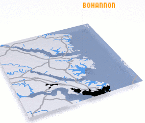 Places with similar names to Bohannon, United States - USA ::
Disclaimer :: Information on this page comes without warranty of any kind |
||
|
Where is Bohannon? Elevation and coordinates ::
Latitude (lat): 37°23'48"N Longitude (lon): 76°21'37"W
Elevation (approx.): 11m (map arrows pan, magnifying glasses zoom) |
||
|
Visiting Bohannon? Hotel/Accommodation ::
Book a hotel in Bohannon Travel Guide ::
rental cars ::
car rental offers GPS waypoint ::
download a GPX waypoint (PoI) of Bohannon for your GPS receiver
|
||