|
search place name
|
||
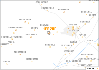
Hebron (Virginia, United States - USA)Hebron is a town in the Virginia region of United States - USA. An overview map of the region around Hebron is displayed below.
regional and 3d topo map of Hebron, United States - USA ::
Hebron airports ::
The nearest airport is EKN - Elkins Randolph Co Jennings Randolph, located 103.1 km north west of Hebron.
Other airports nearby include IAD - Washington Dulles Intl (172.9 km north east), RIC - Richmond Intl (176.4 km south east), Nearby towns ::
Snyder (1.2km east) //
Cedar Green (2.5km north east) //
West View (3.3km north west) //
Arbor Hill (4.7km south) //
Swoope (4.8km west) //
Plunkettsville (5.5km east) //
Trimbles Mill (5.6km west) //
Staunton Park (6.0km north east) //
Folly Mills (6.9km south east) //
West End (6.8km east) //
Dogwood Hill (6.9km east) //
Christian (7.8km north west) //
Mint Spring (8.9km south east) //
Brookwood (9.2km south east) //
[all distances 'as the bird flies' and approximate]  Places with similar names to Hebron, United States - USA ::
Disclaimer :: Information on this page comes without warranty of any kind |
||
|
Where is Hebron? Elevation and coordinates ::
Latitude (lat): 38°8'30"N Longitude (lon): 79°9'20"W
Elevation (approx.): 482m (map arrows pan, magnifying glasses zoom) |
||
|
Visiting Hebron? Hotel/Accommodation ::
Book a hotel in Hebron Travel Guide ::
rental cars ::
car rental offers GPS waypoint ::
download a GPX waypoint (PoI) of Hebron for your GPS receiver
|
||