|
search place name
|
||
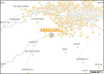
Poages Mill (Virginia, United States - USA)Poages Mill is a town in the Virginia region of United States - USA. An overview map of the region around Poages Mill is displayed below.
regional and 3d topo map of Poages Mill, United States - USA ::
Poages Mill airports ::
The nearest airport is INT - Winston-salem Smith Reynolds, located 119.0 km south of Poages Mill.
Other airports nearby include RDU - Raleigh-durham Raleigh Durham Intl (185.4 km south east), EKN - Elkins Randolph Co Jennings Randolph (188.6 km north), HKY - Hickory Rgnl (201.0 km south west), CLT - Charlotte Douglas Intl (234.1 km south), Nearby towns ::
Falcon Ridge Estates (0.2km north west) //
Holly Ridge (0.6km west) //
Farris Heights (1.0km north east) //
Highfields Farm Estates (1.5km west) //
Brookwood (1.9km north east) //
Kings Forest (2.1km west) //
Homeplace (2.5km north east) //
Homewood (2.5km north east) //
Poages Mill Estates (2.4km north west) //
Waltdon Farms (2.8km north) //
Bridlewood (2.5km north east) //
Briar Ridge (2.5km east) //
Sugar Loaf Hills (3.5km north) //
Highfields (3.3km north east) //
Old Mill Forest (3.1km east) //
Rosecrest (3.3km north east) //
Scenic Hills (3.2km east) //
Mount Vernon Forest (3.4km north east) //
Adam Acres (3.6km north east) //
Canterbury Park (3.8km north east) //
Arlington Forest (3.6km east) //
Arlington Hills (3.8km north east) //
Castle Rock West (4.3km north east) //
Nichols Estates (3.9km north east) //
Castle Rock Farms (4.3km north east) //
Nottingham Heights (4.3km north east) //
Nottingham Hills (4.3km north east) //
Country Hills (4.0km north west) //
Lynn Dell Estates (3.9km north east) //
[all distances 'as the bird flies' and approximate]  Places with similar names to Poages Mill, United States - USA :: Disclaimer :: Information on this page comes without warranty of any kind |
||
|
Where is Poages Mill? Elevation and coordinates ::
Latitude (lat): 37°11'53"N Longitude (lon): 80°3'24"W
Elevation (approx.): 397m (map arrows pan, magnifying glasses zoom) |
||
|
Visiting Poages Mill? Hotel/Accommodation ::
Book a hotel in Poages Mill Travel Guide ::
rental cars ::
car rental offers GPS waypoint ::
download a GPX waypoint (PoI) of Poages Mill for your GPS receiver
|
||