|
search place name
|
||
Pungoteague (Virginia, United States - USA)Pungoteague is a town in the Virginia region of United States - USA. An overview map of the region around Pungoteague is displayed below.
regional and 3d topo map of Pungoteague, United States - USA ::

Pungoteague airports ::
The nearest airport is LFI - Hampton Langley Afb, located 77.7 km south west of Pungoteague.
Other airports nearby include PHF - Newport News Williamsburg Intl (81.7 km south west), SBY - Salisbury Ocean City Wicomico Rgnl (83.2 km north), NGU - Norfolk Ns (87.7 km south west), ORF - Norfolk Intl (88.6 km south west), Nearby towns ::
Pennyville (2.2km south west) //
Bobtown (2.9km north east) //
Harborton (3.8km north west) //
Boston (3.5km south west) //
Nandua (3.3km west) //
Coocheyville (3.9km north west) //
Mount Nebo (5.0km north) //
Middlesex (5.1km south) //
Smithville (4.9km north west) //
Crockett Town (5.6km north) //
Keller (4.5km east) //
Little Hell (5.1km north east) //
Painter (5.6km south east) //
Middlesex (6.0km south) //
Hacksneck (5.2km west) //
Locksville (6.2km north east) //
Coal Kiln Crossing (6.8km south) //
Cedar View (5.8km west) //
Mount Zion (7.7km south) //
Cashville (8.0km north) //
Red Hill (6.9km south east) //
Shields (7.6km south west) //
Mappsburg (7.3km south east) //
Craddockville (7.3km south west) //
Melfa (6.7km east) //
Trower (6.9km south east) //
Savageville (7.5km north east) //
Belle Haven (8.5km south) //
Savage Town (8.8km south) //
[all distances 'as the bird flies' and approximate] 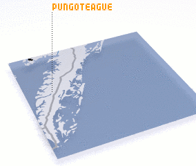 Places with similar names to Pungoteague, United States - USA ::
// Pangdag (MM)
// Pang Ta Hka (MM)
// Pangta-hka (MM)
// Paungdok (MM)
// Pongdŏk (KR)
// P'ungdŏk (KP)
// Pongdŏk (KR)
// Pangadiéka (TG)
// Pangdaokou (CN)
Disclaimer :: Information on this page comes without warranty of any kind |
||
|
Where is Pungoteague? Elevation and coordinates ::
Latitude (lat): 37°37'49"N Longitude (lon): 75°48'50"W
Elevation (approx.): 12m (map arrows pan, magnifying glasses zoom) |
||
|
Visiting Pungoteague? Hotel/Accommodation ::
Book a hotel in Pungoteague Travel Guide ::
rental cars ::
car rental offers GPS waypoint ::
download a GPX waypoint (PoI) of Pungoteague for your GPS receiver
|
||