|
search place name
|
||
Stringtown (Virginia, United States - USA)Stringtown is a town in the Virginia region of United States - USA. An overview map of the region around Stringtown is displayed below.
regional and 3d topo map of Stringtown, United States - USA ::

Stringtown airports ::
The nearest airport is IAD - Washington Dulles Intl, located 52.7 km south east of Stringtown.
Other airports nearby include DCA - Ronald Reagan Washington Natl (89.6 km south east), ADW - Camp Springs Andrews Afb (Washington Dc Naf) (105.0 km south east), BWI - Baltimore Washington Intl (113.2 km east), AOO - Altoona Blair Co (126.5 km north), Nearby towns ::
Longmarsh Acres (0.9km south east) //
Trapp Hill (2.5km south) //
Fairfield (2.4km north east) //
Wilson (2.1km east) //
Lewisville (2.7km north east) //
Cather Estates (2.7km north west) //
Bradfield (3.2km south east) //
Kinfield Estates (2.9km north east) //
Berryville (4.1km south) //
Battletown (4.5km south) //
Treadwell (4.6km south) //
Mount Pleasant (4.0km south west) //
Franklintown (4.2km north east) //
Gaylord (4.1km east) //
Jamestown (6.0km north) //
Webbtown (6.1km south east) //
Swimley (6.6km north west) //
Summit Point (7.0km north) //
Vista Estates (7.4km south east) //
Blue Ridge Estates (7.4km south east) //
Mount Pleasant (8.3km north) //
Rippon (7.1km north east) //
Wadesville (8.0km north west) //
Arcadia Farm (8.4km south east) //
Wheatland (8.6km north east) //
Chilly Hollow Estates (10.0km south east) //
[all distances 'as the bird flies' and approximate] 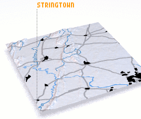 Places with similar names to Stringtown, United States - USA ::
// Stringtown (US)
// Stringtown (US)
// Stringtown (US)
// Stringtown (US)
// Stringtown (US)
// Stringtown (US)
// Stringtown (US)
// Stringtown (US)
// Stringtown (US)
// Stringtown (US)
Disclaimer :: Information on this page comes without warranty of any kind |
||
|
Where is Stringtown? Elevation and coordinates ::
Latitude (lat): 39°11'17"N Longitude (lon): 77°58'42"W
Elevation (approx.): 196m (map arrows pan, magnifying glasses zoom) |
||
|
Visiting Stringtown? Hotel/Accommodation ::
Book a hotel in Stringtown Travel Guide ::
rental cars ::
car rental offers GPS waypoint ::
download a GPX waypoint (PoI) of Stringtown for your GPS receiver
|
||