|
search place name
|
||
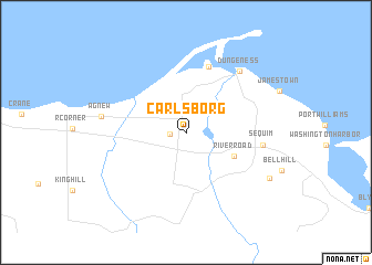
Carlsborg (Washington, United States - USA)Carlsborg is a town in the Washington region of United States - USA. An overview map of the region around Carlsborg is displayed below.
regional and 3d topo map of Carlsborg, United States - USA ::
Carlsborg airports ::
The nearest airport is YYJ - Victoria Intl, located 64.7 km north of Carlsborg.
Other airports nearby include PAE - Everett Snohomish Co (69.5 km east), BFI - Seattle Boeing Fld King Co Intl (90.1 km south east), BLI - Bellingham Intl (91.0 km north east), SEA - Seattle Tacoma Intl (96.2 km south east), Nearby towns ::
Rena (1.1km west) //
River Road (4.0km south east) //
Old Town (6.8km north) //
Sequim (5.4km east) //
Dungeness (7.2km north east) //
Agnew (5.9km west) //
Happy Valley (7.3km south east) //
[all distances 'as the bird flies' and approximate]  Places with similar names to Carlsborg, United States - USA ::
// Kreilesberg (AT)
// Carlsberg (DE)
// Greilsberg (DE)
// Karlsberg (DE)
// Carlsburg (US)
// Carolusberg (ZA)
// Carlsbourg (BE)
// Karlsburg (DE)
// Carlsberg (DE)
// Karlsberg (SE)
Disclaimer :: Information on this page comes without warranty of any kind |
||
|
Where is Carlsborg? Elevation and coordinates ::
Latitude (lat): 48°5'27"N Longitude (lon): 123°10'15"W
Elevation (approx.): 55m (map arrows pan, magnifying glasses zoom) |
||
|
Visiting Carlsborg? Hotel/Accommodation ::
Book a hotel in Carlsborg Travel Guide ::
rental cars ::
car rental offers GPS waypoint ::
download a GPX waypoint (PoI) of Carlsborg for your GPS receiver
|
||