|
search place name
|
||
Landisburg (West Virginia, United States - USA)Landisburg is a town in the West Virginia region of United States - USA. An overview map of the region around Landisburg is displayed below.
regional and 3d topo map of Landisburg, United States - USA ::

Landisburg airports ::
The nearest airport is EKN - Elkins Randolph Co Jennings Randolph, located 138.6 km north east of Landisburg.
Other airports nearby include INT - Winston-salem Smith Reynolds (214.3 km south), LCK - Columbus Rickenbacker Intl (267.0 km north west), Nearby towns ::
Clifftop (3.0km north) //
Pittman (2.9km south east) //
Maplewood (5.7km south) //
Ravenseye (4.9km north east) //
Hilton Village (5.4km north east) //
Danese (6.1km south east) //
Chestnut Knob (6.6km south west) //
Layland Heights (7.9km south) //
Medo (8.8km north) //
Winona (9.0km north west) //
Corliss (8.8km north east) //
Beauty (10.1km north west) //
[all distances 'as the bird flies' and approximate] 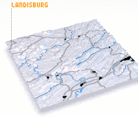 Places with similar names to Landisburg, United States - USA ::
// Lindsberg (AT)
// Lonitzberg (AT)
// Landasberg (DE)
// Landesbrück (DE)
// Landsberg (DE)
// Lindsborg (US)
// Landisburg (US)
// Landsburg (US)
// Lindesberg (SE)
// Lindesberg (SE)
Disclaimer :: Information on this page comes without warranty of any kind |
||
|
Where is Landisburg? Elevation and coordinates ::
Latitude (lat): 37°58'37"N Longitude (lon): 80°56'25"W
Elevation (approx.): 760m (map arrows pan, magnifying glasses zoom) |
||
|
Visiting Landisburg? Hotel/Accommodation ::
Book a hotel in Landisburg Travel Guide ::
rental cars ::
car rental offers GPS waypoint ::
download a GPX waypoint (PoI) of Landisburg for your GPS receiver
|
||