|
search place name
|
||
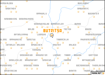
Bu Trit Sa (Sông Bé, Vietnam)Bu Trit Sa is a town in the Sông Bé region of Vietnam. An overview map of the region around Bu Trit Sa is displayed below.
regional and 3d topo map of Bu Trit Sa, Vietnam ::
Bu Trit Sa airports ::
The nearest airport is SGN - Ho Chi Minh City Tansonnhat Intl, located 98.3 km south of Bu Trit Sa.
Other airports nearby include PNH - Phnom-penh Phnom Penh Intl (210.3 km west), Nearby towns ::
Bu Man Ban Trát (2) (2.6km north east) //
Bu Trit Nho (2.6km south east) //
Luong Võ (3.6km west) //
Phu Trít (4.1km south east) //
Bu Man Ca Lem (4.1km north east) //
Ta Ban Calim (4.1km south east) //
Bu Trit Dầm (2) (4.1km north east) //
Ấp Ðông Tâu (4.1km north west) //
Ấp Luoc Ma (5.2km south west) //
Srok Ruông Lào (5.2km north west) //
Toc Têh (5.8km east) //
Ấp Soc Soan (5.8km west) //
Ấp Tra Thanh (5.8km west) //
Ấp Soc Xiem (6.6km south west) //
Bu R'dang (6.6km north east) //
Srok Bou M”lou (6.6km north west) //
Lien Ða (2) (7.6km south) //
Ấp Lo O (7.5km west) //
Ðông Tưu (7.5km west) //
Tân Hưng (7.8km south west) //
An Lộc (1) (8.2km south east) //
Ấp Hưng Yên (8.3km south west) //
Ấp Phum Lu (8.3km north west) //
Ta Ban (9.2km south east) //
[all distances 'as the bird flies' and approximate]  Places with similar names to Bu Trit Sa, Vietnam ::
Disclaimer :: Information on this page comes without warranty of any kind |
||
|
Where is Bu Trit Sa? Elevation and coordinates ::
Latitude (lat): 11°42'0"N Longitude (lon): 106°46'0"E
Elevation (approx.): 93m (map arrows pan, magnifying glasses zoom) |
||
|
Visiting Bu Trit Sa? Hotel/Accommodation ::
Book a hotel in Bu Trit Sa Travel Guide ::
Buy a travel guide for Vietnam rental cars ::
car rental offers GPS waypoint ::
download a GPX waypoint (PoI) of Bu Trit Sa for your GPS receiver
|
||