|
search place name
|
||
Lâm Môn (Quảng Nam-Ðà Nẵng, Vietnam)Lâm Môn is a town in the Quảng Nam-Ðà Nẵng region of Vietnam. An overview map of the region around Lâm Môn is displayed below.
regional and 3d topo map of Lâm Môn, Vietnam ::

Lâm Môn airports ::
The nearest airport is DAD - Danang Intl, located 59.8 km north of Lâm Môn.
Nearby towns ::
Tân Vinh (2) (0.0km north) //
Phước Tân (1.9km south) //
Ðưong Ðà (1.9km south) //
Ðịch An (1) (2.6km south west) //
Tài Ða (3) (2.6km south west) //
Tan An (2.6km south east) //
Ðai Ðồng (2.6km north west) //
Thanh Ðưc (2.6km north east) //
Ðịch An Tây (3.6km west) //
Thôn Hai (2) (3.7km north) //
Ðai Ðông Ðong (3.7km north) //
Ðai Quy (3.7km north) //
Phước Lan (1) (4.1km south west) //
Tân An Ðông (1) (4.1km south west) //
Ðịch Yên (4.0km south west) //
Cẩm Long (4.1km north west) //
Phu Lai (4.1km north east) //
Xuân An (1) (5.1km north east) //
Phú Thu (5.6km north) //
Long Sơn (7) (5.7km east) //
Kỳ Tân (5.7km east) //
Lộc Sơn (1) (5.8km north) //
Phước Lâm (2) (5.8km south) //
Tân Tây (3) (5.8km south) //
Chiên Ðàng (5.7km east) //
Cẩm Khê (1) (5.8km north) //
Qui Xuân (5.8km north) //
An Hoa (1) (6.5km south west) //
Tây Lộc (1) (6.6km north west) //
[all distances 'as the bird flies' and approximate] 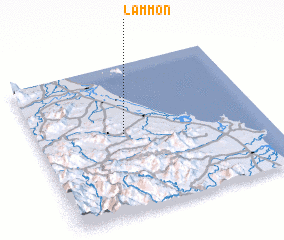 Places with similar names to Lâm Môn, Vietnam ::
Disclaimer :: Information on this page comes without warranty of any kind |
||
|
Where is Lâm Môn? Elevation and coordinates ::
Latitude (lat): 15°32'0"N Longitude (lon): 108°23'0"E
Elevation (approx.): 30m (map arrows pan, magnifying glasses zoom) |
||
|
Visiting Lâm Môn? Hotel/Accommodation ::
Book a hotel in Lâm Môn Travel Guide ::
Buy a travel guide for Vietnam rental cars ::
car rental offers GPS waypoint ::
download a GPX waypoint (PoI) of Lâm Môn for your GPS receiver
|
||