|
search place name
|
||
Nguyệt Chư (Thanh Hóa, Vietnam)Nguyệt Chư is a town in the Thanh Hóa region of Vietnam. An overview map of the region around Nguyệt Chư is displayed below.
regional and 3d topo map of Nguyệt Chư, Vietnam ::

Nguyệt Chư airports ::
The nearest airport is HAN - Hanoi Noibai Intl, located 185.0 km north of Nguyệt Chư.
Nearby towns ::
Ô Cách (0.0km north) //
Cầu Ðông (0.0km north) //
Chau Khe (0.0km north) //
Tiên Vực (1.7km west) //
Lièn Bình (1.9km north) //
Trieu Luong Xom (1.7km east) //
Phong Thái Ðoài (1.7km east) //
Nhàn Hưng (1.7km east) //
Hô Trung (1.9km south) //
Mỹ Thành (2.5km north west) //
Liên Hồ Hào (2.5km south west) //
Hồ Thương (2.5km south east) //
Xuân Viên Ðông (2.5km south east) //
Ðông Lý (3.5km west) //
Mỹ Hà (3.7km north) //
Tho Cưu (3.7km south) //
Hồ Phú (3.7km south) //
Tào Thôn (4.1km north west) //
Chuế Tàn (4.1km north west) //
Phụng Cát (4.1km north west) //
Thượng Còng (4.0km north west) //
Câu Xóm (4.0km north west) //
Dong Tao (4.0km north west) //
Yên Tôn (4.0km north west) //
Hoang Xa (4.1km north east) //
Năng Cải (4.0km north east) //
Nhân Lễ Thượng (5.1km south west) //
Du Hiên (5.1km south west) //
Nạp Bảng (5.1km south west) //
[all distances 'as the bird flies' and approximate] 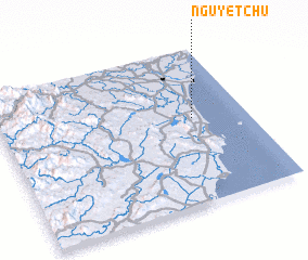 Places with similar names to Nguyệt Chư, Vietnam :: Disclaimer :: Information on this page comes without warranty of any kind |
||
|
Where is Nguyệt Chư? Elevation and coordinates ::
Latitude (lat): 19°33'0"N Longitude (lon): 105°47'0"E
Elevation (approx.): 10m (map arrows pan, magnifying glasses zoom) |
||
|
Visiting Nguyệt Chư? Hotel/Accommodation ::
Book a hotel in Nguyệt Chư Travel Guide ::
Buy a travel guide for Vietnam rental cars ::
car rental offers GPS waypoint ::
download a GPX waypoint (PoI) of Nguyệt Chư for your GPS receiver
|
||