|
search place name
|
||
Al ‘Alāmah (‘Adan, Yemen)Al ‘Alāmah is a town in the ‘Adan region of Yemen. An overview map of the region around Al ‘Alāmah is displayed below.
regional and 3d topo map of Al ‘Alāmah, Yemen ::

Nearby towns ::
Dayrah (1.9km north) //
Al Jawb (2.6km north east) //
‘Ans Sufyān (3.7km south) //
Al Harūj (5.0km west) //
Al Harūj (5.1km west) //
Al Ḩashnah (5.7km east) //
Jarf Isbīl (6.5km north) //
Al Ḩusaymah (7.7km south east) //
Al Kawlah (8.1km south west) //
As Suwaydāʼ (8.2km north west) //
Kharbat Afīk (8.1km south west) //
Al Kawlah (8.2km south west) //
Sanabān (8.6km south) //
Khirbat Afīq (9.1km north west) //
Bayt al Bāqirī (10.3km south east) //
[all distances 'as the bird flies' and approximate] 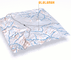 Places with similar names to Al ‘Alāmah, Yemen ::
Disclaimer :: Information on this page comes without warranty of any kind |
||
|
Where is Al ‘Alāmah? Elevation and coordinates ::
Latitude (lat): 14°30'0"N Longitude (lon): 44°39'0"E
Elevation (approx.): 2462m (map arrows pan, magnifying glasses zoom) |
||
|
Visiting Al ‘Alāmah? Hotel/Accommodation ::
Book a hotel in Al ‘Alāmah Travel Guide ::
Buy a travel guide for Yemen rental cars ::
car rental offers GPS waypoint ::
download a GPX waypoint (PoI) of Al ‘Alāmah for your GPS receiver
|
||