|
search place name
|
||
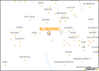
Al Ḩaḑramī (‘Adan, Yemen)Al Ḩaḑramī is a town in the ‘Adan region of Yemen. An overview map of the region around Al Ḩaḑramī is displayed below.
regional and 3d topo map of Al Ḩaḑramī, Yemen ::
Nearby towns ::
Ahl ‘Īsá (1.9km north) //
Āl ‘Īsá (2.1km south east) //
As Sūdāʼ (2.1km north west) //
Al Qū‘ah (3.7km west) //
Al Maqfal (4.0km north east) //
Al Bayḑāʼ (4.2km east) //
Ghirrān (5.0km north) //
Zahir (5.4km west) //
Ḩayd ‘Alī (5.7km east) //
Al Muţrif (6.4km north east) //
Rahiya (6.5km south east) //
‘Azzah (6.9km north east) //
Umm Dijarah (7.0km east) //
Ash Sharaf (7.0km east) //
Al Hajar (7.4km east) //
Mukayris (8.0km north east) //
Ar Raysh (8.1km south east) //
Ar Raḩabah (8.1km south east) //
Al Mikḩal (8.5km north) //
Qarīḑah (8.7km north) //
Ar Rawḑah (8.7km north east) //
As Sa‘īdīyah (9.2km north east) //
Ghaylamah (9.4km north west) //
Quriba (10.3km south east) //
[all distances 'as the bird flies' and approximate]  Places with similar names to Al Ḩaḑramī, Yemen :: Disclaimer :: Information on this page comes without warranty of any kind |
||
|
Where is Al Ḩaḑramī? Elevation and coordinates ::
Latitude (lat): 13°58'0"N Longitude (lon): 45°32'0"E
Elevation (approx.): 2021m (map arrows pan, magnifying glasses zoom) |
||
|
Visiting Al Ḩaḑramī? Hotel/Accommodation ::
Book a hotel in Al Ḩaḑramī Travel Guide ::
Buy a travel guide for Yemen rental cars ::
car rental offers GPS waypoint ::
download a GPX waypoint (PoI) of Al Ḩaḑramī for your GPS receiver
|
||