|
search place name
|
||
Barwaj (Ḩaḑramawt, Yemen)Barwaj is a town in the Ḩaḑramawt region of Yemen. An overview map of the region around Barwaj is displayed below.
regional and 3d topo map of Barwaj, Yemen ::

Barwaj airports ::
The nearest airport is SHW - Sharurah, located 228.7 km north west of Barwaj.
Nearby towns ::
Sāḩat al Ḩaḑārim (1.2km east) //
Al Furuţ (1.6km north west) //
Al Qaţn (1.8km east) //
Al Muraqqadah (1.9km north east) //
Shaklayn (2.5km south east) //
Zarqāwah (2.9km east) //
Az Zū‘ (2.9km east) //
Faḑaḩ (4.8km south west) //
Sāḩat Āl Jaḩwarī (4.7km east) //
Al Bāţinah (4.8km south west) //
Al Ḩudayd (4.8km south west) //
Sharj Āl az Zū‘ (4.8km west) //
Ḩayd Ţālib ar Rizq (5.8km north east) //
Quzaibah (6.0km south) //
Zukaykah (6.0km north) //
Al Mazharah (5.9km south west) //
Qusays (6.3km north east) //
Zakrīyah (6.4km south) //
Al ‘Uqaydah (6.4km south) //
An Nābidhah (6.9km north west) //
Ḩawţat an Nūr (6.8km east) //
Al Kulayb (7.3km south west) //
Mankhar (7.4km south west) //
Al Bilād (7.8km south) //
Al Kharābah (7.8km south) //
Ḩuşūn Āl Kuwayr (7.8km west) //
Jūwat Āl al Muhannā (8.2km west) //
Āl Jaḩwarī (8.3km east) //
Al ‘Anīn (8.4km east) //
[all distances 'as the bird flies' and approximate] 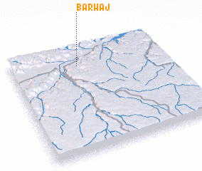 Places with similar names to Barwaj, Yemen ::
// Borowaja (UA)
Disclaimer :: Information on this page comes without warranty of any kind |
||
|
Where is Barwaj? Elevation and coordinates ::
Latitude (lat): 15°50'12"N Longitude (lon): 48°26'22"E
Elevation (approx.): 703m (map arrows pan, magnifying glasses zoom) |
||
|
Visiting Barwaj? Hotel/Accommodation ::
Book a hotel in Barwaj Travel Guide ::
Buy a travel guide for Yemen rental cars ::
car rental offers GPS waypoint ::
download a GPX waypoint (PoI) of Barwaj for your GPS receiver
|
||