|
search place name
|
||
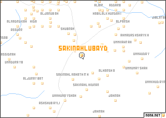
Sākin Ahl ‘Ubayd (‘Adan, Yemen)Sākin Ahl ‘Ubayd is a town in the ‘Adan region of Yemen. An overview map of the region around Sākin Ahl ‘Ubayd is displayed below.
regional and 3d topo map of Sākin Ahl ‘Ubayd, Yemen ::
Nearby towns ::
‘Arākibī (2.6km north west) //
Shabḩah (2.6km north west) //
Umm Ḑubbah (3.8km south east) //
Umm ‘Ayn (4.7km north west) //
Sākin Ahl Mahāthīth (5.1km south west) //
Umm Salāmīyah (5.3km north east) //
Qaryat Ahl Hidrān (5.7km south east) //
Al Khurf (5.7km east) //
Al Qā‘ (5.8km north) //
Shubrām (6.5km north west) //
Al Ḩarshāʼ (6.6km south east) //
Sākin Ahl Hidrān (7.1km south) //
Qarn al Waḑī‘ (7.3km east) //
Khurf (7.6km north) //
Al Baţr (8.2km north east) //
Umm Mahāthīth (8.5km south) //
Sākin Ahl Sādah (8.7km north east) //
Qashshāsh (9.2km north west) //
Al Kharabīyah (9.1km north east) //
Adh Dha‘nūb (9.2km south east) //
Şurrat Āl Mas‘ūd (9.2km south east) //
Nu‘mān (10.3km north west) //
Makrārah (10.3km north east) //
Umm Khudayrah (10.7km north east) //
Jawf Umm Maqbābah (10.9km north west) //
[all distances 'as the bird flies' and approximate]  Places with similar names to Sākin Ahl ‘Ubayd, Yemen ::
// Signal Butte (US)
Disclaimer :: Information on this page comes without warranty of any kind |
||
|
Where is Sākin Ahl ‘Ubayd? Elevation and coordinates ::
Latitude (lat): 13°46'0"N Longitude (lon): 45°54'0"E
Elevation (approx.): 898m (map arrows pan, magnifying glasses zoom) |
||
|
Visiting Sākin Ahl ‘Ubayd? Hotel/Accommodation ::
Book a hotel in Sākin Ahl ‘Ubayd Travel Guide ::
Buy a travel guide for Yemen rental cars ::
car rental offers GPS waypoint ::
download a GPX waypoint (PoI) of Sākin Ahl ‘Ubayd for your GPS receiver
|
||