|
search place name
|
||
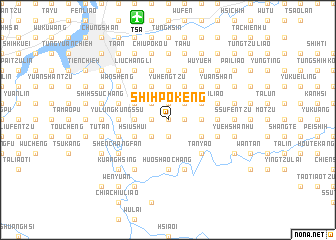
Shih-p'o-k'eng (T'ai-pei, Taiwan)Shih-p'o-k'eng is a town in the T'ai-pei region of Taiwan. An overview map of the region around Shih-p'o-k'eng is displayed below.
regional and 3d topo map of Shih-p'o-k'eng, Taiwan ::
Shih-p'o-k'eng airports ::
The nearest airport is TSA - Taipei Sungshan, located 11.8 km north of Shih-p'o-k'eng.
Other airports nearby include TPE - Taipei Chiang Kai Shek Intl (37.5 km west), HUN - Hualien (104.6 km south), OGN - Yonaguni Jima Yonaguni (151.6 km east), CYI - Chiayi (205.9 km south west), Nearby towns ::
Chih-nan-ts'un (0.0km north) //
Mao-k'ung (0.0km north) //
Ch'i-shan (0.0km north) //
Ch'i-tzu-t'ou (0.0km north) //
Ch'u-tzu-yüan-k'eng (1.9km north) //
Hsiao-k'eng (1.9km north) //
T'an-pien (1.7km west) //
Te-kao-ling (1.7km west) //
Chang-hu (1.7km west) //
Lei-kung-p'o (1.7km east) //
Ts'ao-nan (1.7km east) //
Fan-shu-liao (1.7km east) //
Lao-liao (1.7km east) //
Shih-fen (1.9km south) //
Shih-liu-fen (1.9km south) //
Liu-fen-tzu (1.9km south) //
Mu-cha (2.5km north west) //
Tai-lao-k'eng (2.5km north west) //
Hsing-lung (2.5km north west) //
Chih-nan-shan-chuang (2.5km north west) //
P'ao-tzu-lin (2.5km north west) //
A-jou-yang (2.5km north east) //
A-Sang-k'eng (2.5km north east) //
Ta-lun-wei (2.5km north east) //
P'ao-tzu-lun (2.5km north east) //
Ssu-shih-fen (2.5km south west) //
Mei-tzu-liao (2.5km south west) //
Hu-shan-k'eng (2.5km south west) //
Hsiang-t'ou-pu (3.7km north) //
[all distances 'as the bird flies' and approximate]  Places with similar names to Shih-p'o-k'eng, Taiwan ::
// Shapahkang (MM)
// Chupacanca (PE)
// Chih-po-k'eng (TW)
// Shih-p'ai-k'eng (TW)
// Shih-pi-k'eng (TW)
// Hsia-po-kung (TW)
// Hsiao-pei-k'eng (TW)
// Hsiao-pei-k'eng (TW)
// Shu-pai-kung (TW)
Disclaimer :: Information on this page comes without warranty of any kind |
||
|
Where is Shih-p'o-k'eng? Elevation and coordinates ::
Latitude (lat): 24°58'0"N Longitude (lon): 121°35'0"E
Elevation (approx.): 287m (map arrows pan, magnifying glasses zoom) |
||
|
Visiting Shih-p'o-k'eng? Hotel/Accommodation ::
Book a hotel in Shih-p'o-k'eng Travel Guide ::
Buy a travel guide for Taiwan rental cars ::
car rental offers GPS waypoint ::
download a GPX waypoint (PoI) of Shih-p'o-k'eng for your GPS receiver
|
||