|
search place name
|
||
Zavoj (Srbija, Serbia and Montenegro)Zavoj is a town in the Srbija region of Serbia and Montenegro. An overview map of the region around Zavoj is displayed below.
regional and 3d topo map of Zavoj, Serbia and Montenegro ::

Zavoj airports ::
The nearest airport is INI - Nis, located 65.1 km west of Zavoj.
Other airports nearby include SOF - Sofia (88.5 km south east), PRN - Pristina (152.7 km south west), CRA - Craiova (153.6 km north east), SKP - Skopje (167.7 km south west), Nearby towns ::
Mala Lukanja (2.4km south east) //
Pokrevenik (3.1km south west) //
Velika Lukanja (4.2km south east) //
Koprivštica (4.3km south west) //
Gostuša (3.9km east) //
Dobri Do (6.0km south) //
Zaskovci (7.3km north west) //
Nišor (7.2km south west) //
Bela (6.8km south east) //
Topli Do (8.4km north) //
Oreovica (6.7km west) //
[all distances 'as the bird flies' and approximate] 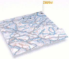 Places with similar names to Zavoj, Serbia and Montenegro ::
Disclaimer :: Information on this page comes without warranty of any kind |
||
|
Where is Zavoj? Elevation and coordinates ::
Latitude (lat): 43°16'0"N Longitude (lon): 22°39'0"E
Elevation (approx.): 759m (map arrows pan, magnifying glasses zoom) |
||
|
Visiting Zavoj? Hotel/Accommodation ::
Book a hotel in Zavoj Travel Guide ::
rental cars ::
car rental offers GPS waypoint ::
download a GPX waypoint (PoI) of Zavoj for your GPS receiver
|
||