|
search place name
|
||
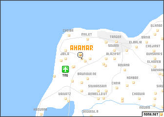
Ahamar (Tanger, Morocco)Ahamar is a town in the Tanger region of Morocco. An overview map of the region around Ahamar is displayed below.
regional and 3d topo map of Ahamar, Morocco ::
Ahamar airports ::
The nearest airport is TNG - Tanger Ibn Batouta, located 4.0 km south west of Ahamar.
Other airports nearby include TTU - Tetouan Saniat Rmel (53.8 km east), GIB - Gibraltar (65.6 km north east), XRY - Jerez (111.5 km north), OZP - Sevilla Moron Ab (159.9 km north), Nearby towns ::
Magaïr (0.0km north) //
Ziaten (0.9km south east) //
Branes (1.5km east) //
Dar Sultan (2.4km south west) //
Boukhalef (2.6km south west) //
Jbila (3.0km west) //
Mediouna (3.5km north west) //
Rmilet (4.6km north) //
Mediouna (3.9km west) //
Badriouene (4.8km south) //
Beni Touzine (4.2km east) //
Chouikrech (5.6km south) //
Beni Ouriarhel (4.5km east) //
Gzennaïa (5.5km south) //
Beni Saïd (4.7km east) //
Cheïba (5.8km north west) //
Dradeb (5.8km north east) //
Al Azifat (6.0km east) //
Dar Zhirou (7.4km south) //
Hajreien (6.5km south west) //
Souani (6.3km east) //
Sidi Hassaïn (8.0km south) //
Tanger (7.4km north east) //
Khendek Zarzour (8.7km south east) //
Chria (9.4km south east) //
[all distances 'as the bird flies' and approximate] 
Disclaimer :: Information on this page comes without warranty of any kind |
||
|
Where is Ahamar? Elevation and coordinates ::
Latitude (lat): 35°45'0"N Longitude (lon): 5°53'0"W
Elevation (approx.): 76m (map arrows pan, magnifying glasses zoom) |
||
|
Visiting Ahamar? Hotel/Accommodation ::
Book a hotel in Ahamar Travel Guide ::
Buy a travel guide for Morocco rental cars ::
car rental offers GPS waypoint ::
download a GPX waypoint (PoI) of Ahamar for your GPS receiver
|
||