|
search place name
|
||
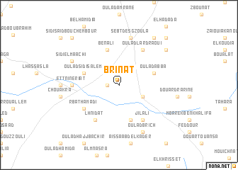
Brinat (Safi, Morocco)Brinat is a town in the Safi region of Morocco. An overview map of the region around Brinat is displayed below.
regional and 3d topo map of Brinat, Morocco ::
Brinat airports ::
The nearest airport is RAK - Marrakech Menara, located 112.0 km south east of Brinat.
Other airports nearby include AGA - Agadir Inezgane (189.8 km south), CMN - Casablanca Mohammed V Intl (203.4 km north east), Nearby towns ::
Rbat El Fkih (1.6km west) //
Douar Dahmane (3.6km south east) //
Zouirat (5.8km south) //
Oulad Abba (5.1km east) //
Oulad Sidi Salem (5.1km west) //
Ben Ali (5.8km north) //
Jilali (6.4km south east) //
Lhnidat (6.4km south west) //
R bat Hamadi (6.0km south west) //
Oulad Lardraoui (6.4km north east) //
Et Tnine Riat (6.3km west) //
Douar Sadna (6.3km west) //
Sebt des Gzoula (7.6km north) //
Oulad Brich (8.1km south east) //
Sidi el Maachi (7.3km north west) //
Douar Oulad Kassem (8.4km north east) //
Douar Sidi Allal (8.8km north east) //
Oulad Bou Azi (9.7km north east) //
Sidi Saïd Bou Chembour (9.7km north west) //
[all distances 'as the bird flies' and approximate]  Places with similar names to Brinat, Morocco ::
Disclaimer :: Information on this page comes without warranty of any kind |
||
|
Where is Brinat? Elevation and coordinates ::
Latitude (lat): 32°3'0"N Longitude (lon): 9°6'0"W
Elevation (approx.): 260m (map arrows pan, magnifying glasses zoom) |
||
|
Visiting Brinat? Hotel/Accommodation ::
Book a hotel in Brinat Travel Guide ::
Buy a travel guide for Morocco rental cars ::
car rental offers GPS waypoint ::
download a GPX waypoint (PoI) of Brinat for your GPS receiver
|
||