|
search place name
|
||
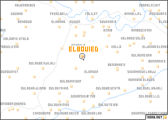
El Bouied (Taounate, Morocco)El Bouied is a town in the Taounate region of Morocco. An overview map of the region around El Bouied is displayed below.
regional and 3d topo map of El Bouied, Morocco ::
El Bouied airports ::
The nearest airport is FEZ - Fez Saiss, located 60.4 km south of El Bouied.
Other airports nearby include MEK - Meknes Bassatine (77.2 km south west), TTU - Tetouan Saniat Rmel (127.2 km north), AHU - Al Hociema Cherif El Idrissi (137.2 km north east), NNA - Kentira Kenitra (141.9 km west), Nearby towns ::
Sghoula (2.3km north) //
Rhefafra (2.4km south west) //
El Anser (4.0km south) //
Kouassem (5.6km north) //
Moulay Bouchta (4.9km north west) //
Dekioukiyene (5.8km north) //
Oulad Ben Addou (5.2km north east) //
Hannaoua (6.2km north) //
Oulad Mimoun (6.3km south) //
Sdider (7.6km north) //
Dehar Bou Mohammed (7.6km north) //
Kolla (6.4km east) //
El Hajer (6.4km east) //
El Haddad (7.6km south) //
Beni Ammer (6.6km east) //
Azaïb (7.2km north east) //
Oulad Hammou (8.4km north east) //
Doukkara (8.7km north east) //
El Hamma (8.7km north west) //
Oulad Bouchta (8.7km south east) //
Oulad Yahia (8.7km south west) //
[all distances 'as the bird flies' and approximate]  Places with similar names to El Bouied, Morocco ::
// El Bied (MA)
// El Bouida (MA)
// El Bateo (PA)
// El Bédia (TD)
// El Bieda (TD)
// El Bote (CO)
// El Beato (MX)
// El Bayyâda (LB)
// El Bouaïda (LB)
// El Abdé (MR)
Disclaimer :: Information on this page comes without warranty of any kind |
||
|
Where is El Bouied? Elevation and coordinates ::
Latitude (lat): 34°28'0"N Longitude (lon): 5°4'0"W
Elevation (approx.): 387m (map arrows pan, magnifying glasses zoom) |
||
|
Visiting El Bouied? Hotel/Accommodation ::
Book a hotel in El Bouied Travel Guide ::
Buy a travel guide for Morocco rental cars ::
car rental offers GPS waypoint ::
download a GPX waypoint (PoI) of El Bouied for your GPS receiver
|
||