|
search place name
|
||
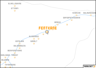
Fentkane (Taza, Morocco)Fentkane is a town in the Taza region of Morocco. An overview map of the region around Fentkane is displayed below.
regional and 3d topo map of Fentkane, Morocco ::
Fentkane airports ::
The nearest airport is AHU - Al Hociema Cherif El Idrissi, located 117.6 km north of Fentkane.
Other airports nearby include FEZ - Fez Saiss (127.8 km west), MLN - Melilla (140.8 km north east), OUD - Oujda Angads (171.6 km north east), MEK - Meknes Bassatine (177.6 km west), Nearby towns ::
Taachort (1.5km west) //
Safsafat (2.4km north east) //
Beni Aziz (3.6km south west) //
Brakik (4.8km north east) //
El Haraïeg (5.0km west) //
Damalt (5.9km south west) //
Safsafat Kissaria (7.2km north east) //
[all distances 'as the bird flies' and approximate] 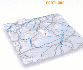 Places with similar names to Fentkane, Morocco ::
// Fond Cani (DM)
// Fandou Keyna (NE)
// Fandou Keyna (NE)
// Foundiougne (SN)
// Fendou Keyna (ML)
// Fond Gouin (HT)
// Fantiékon (VU)
// Fendoucun (CN)
// Fındığan (AZ)
// Fantignie (BE)
Disclaimer :: Information on this page comes without warranty of any kind |
||
|
Where is Fentkane? Elevation and coordinates ::
Latitude (lat): 34°8'0"N Longitude (lon): 3°37'0"W
Elevation (approx.): 504m (map arrows pan, magnifying glasses zoom) |
||
|
Visiting Fentkane? Hotel/Accommodation ::
Book a hotel in Fentkane Travel Guide ::
Buy a travel guide for Morocco rental cars ::
car rental offers GPS waypoint ::
download a GPX waypoint (PoI) of Fentkane for your GPS receiver
|
||