|
search place name
|
||
Goujgal (Marrakech, Morocco)Goujgal is a town in the Marrakech region of Morocco. An overview map of the region around Goujgal is displayed below.
regional and 3d topo map of Goujgal, Morocco ::

Goujgal airports ::
The nearest airport is RAK - Marrakech Menara, located 36.6 km north east of Goujgal.
Other airports nearby include OZZ - Ouarzazate (140.8 km east), AGA - Agadir Inezgane (161.7 km south west), Nearby towns ::
El Jorf (2.4km north east) //
Douar Sidi Arich (3.7km north) //
El Gaïda (3.2km east) //
Frizem (4.0km north east) //
Selk (4.9km north west) //
Oulad Boubker (4.7km west) //
Oulad Dib (5.1km west) //
Mkhalif (6.4km north east) //
Tamerhlecht (6.3km west) //
Taouiloult (7.6km north) //
El Mjed (7.3km north east) //
El Mramda (7.3km south west) //
El Karia (9.7km north east) //
[all distances 'as the bird flies' and approximate] 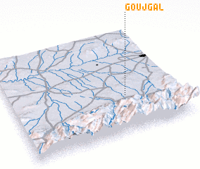 Places with similar names to Goujgal, Morocco ::
// Gjokalli (AL)
// Quejigal (ES)
// Cujacal (CO)
// Gowjeh Gol (IR)
// Kaj Kolāh (IR)
// Gaju Kili (PK)
// Gajigala (NG)
// Kaja-gol (KP)
// Kujae-gol (KP)
// Kujaek-kol (KP)
Disclaimer :: Information on this page comes without warranty of any kind |
||
|
Where is Goujgal? Elevation and coordinates ::
Latitude (lat): 31°22'0"N Longitude (lon): 8°18'0"W
Elevation (approx.): 732m (map arrows pan, magnifying glasses zoom) |
||
|
Visiting Goujgal? Hotel/Accommodation ::
Book a hotel in Goujgal Travel Guide ::
Buy a travel guide for Morocco rental cars ::
car rental offers GPS waypoint ::
download a GPX waypoint (PoI) of Goujgal for your GPS receiver
|
||