|
search place name
|
||
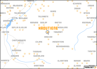
Haoutiene (Chaouen, Morocco)Haoutiene is a town in the Chaouen region of Morocco. An overview map of the region around Haoutiene is displayed below.
regional and 3d topo map of Haoutiene, Morocco ::
Haoutiene airports ::
The nearest airport is TTU - Tetouan Saniat Rmel, located 45.9 km north of Haoutiene.
Other airports nearby include TNG - Tanger Ibn Batouta (89.7 km north west), GIB - Gibraltar (106.8 km north), AHU - Al Hociema Cherif El Idrissi (120.9 km east), FEZ - Fez Saiss (142.2 km south), Nearby towns ::
Taourirt (1.9km south) //
Amazzar (1.9km south) //
Oulad el Haj (3.7km south) //
Taourart (3.0km east) //
Beni Bouker (3.0km east) //
Ouslaf (4.0km north) //
Haouma (4.8km north west) //
Izilane (4.8km south west) //
Ametek (4.8km north east) //
Imeseritene (4.8km south east) //
Agouilane (4.9km east) //
Talembote (6.3km north) //
Aordane (5.9km north west) //
El Aouina (7.6km north) //
Beni Mohammed (7.2km south east) //
Akane (8.3km north) //
Tissouka (8.3km south west) //
Fokaïene (8.7km south west) //
Arrasene (9.6km south west) //
Taghzoute (10.2km north west) //
[all distances 'as the bird flies' and approximate]  Places with similar names to Haoutiene, Morocco ::
Disclaimer :: Information on this page comes without warranty of any kind |
||
|
Where is Haoutiene? Elevation and coordinates ::
Latitude (lat): 35°12'0"N Longitude (lon): 5°10'0"W
Elevation (approx.): 1220m (map arrows pan, magnifying glasses zoom) |
||
|
Visiting Haoutiene? Hotel/Accommodation ::
Book a hotel in Haoutiene Travel Guide ::
Buy a travel guide for Morocco rental cars ::
car rental offers GPS waypoint ::
download a GPX waypoint (PoI) of Haoutiene for your GPS receiver
|
||