|
search place name
|
||
Igalfene (Tiznit, Morocco)Igalfene is a town in the Tiznit region of Morocco. An overview map of the region around Igalfene is displayed below.
regional and 3d topo map of Igalfene, Morocco ::

Igalfene airports ::
The nearest airport is AGA - Agadir Inezgane, located 97.5 km north of Igalfene.
Other airports nearby include TTA - Tan Tan Plage Blanche (174.4 km south west), TIN - Tindouf (265.4 km south east), Nearby towns ::
Id Hammou nʼTaleb (2.0km east) //
Afoud nʼId el Haj Ali (2.8km north) //
Id Ouaousser (3.9km south) //
Sidi Bou Sadakat (3.5km west) //
Taghzout (4.3km north) //
Agadir Ikechrane (4.4km north west) //
Id Oulahiane (4.6km south west) //
Harouach (4.5km south west) //
Agadir Zouggaghine (5.1km south) //
Bouksaa (4.6km west) //
El Ksebt (5.0km south west) //
Bou Ouzrou (5.1km north west) //
Tafrout Imgrad (5.9km south) //
Id Bouhouch (5.4km north east) //
Amouz (5.4km east) //
Agadir Bou Adane (5.6km east) //
Issil (6.0km north east) //
Bouallouz (6.9km north) //
Souk el Arba n Sâhel (7.0km north west) //
Taksiouine (6.9km north west) //
Souk el Had (7.1km south west) //
Id Sidi Ahmed Oufella (7.4km south west) //
Iabbassene (8.2km north) //
Id Ou Mghar (7.8km south east) //
Talat nʼTiki (8.3km south) //
Amʼaïch (7.9km north west) //
Agadir Oufella (8.1km north east) //
Larjam (7.9km east) //
Id Baha (8.9km north) //
[all distances 'as the bird flies' and approximate] 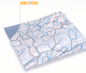
Disclaimer :: Information on this page comes without warranty of any kind |
||
|
Where is Igalfene? Elevation and coordinates ::
Latitude (lat): 29°33'11"N Longitude (lon): 9°53'13"W
Elevation (approx.): 296m (map arrows pan, magnifying glasses zoom) |
||
|
Visiting Igalfene? Hotel/Accommodation ::
Book a hotel in Igalfene Travel Guide ::
Buy a travel guide for Morocco rental cars ::
car rental offers GPS waypoint ::
download a GPX waypoint (PoI) of Igalfene for your GPS receiver
|
||