|
search place name
|
||
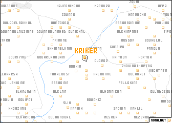
Kriker (Sidi Kacem, Morocco)Kriker is a town in the Sidi Kacem region of Morocco. An overview map of the region around Kriker is displayed below.
regional and 3d topo map of Kriker, Morocco ::
Kriker airports ::
The nearest airport is MEK - Meknes Bassatine, located 91.3 km south of Kriker.
Other airports nearby include FEZ - Fez Saiss (96.1 km south east), TTU - Tetouan Saniat Rmel (99.9 km north), NNA - Kentira Kenitra (114.3 km south west), TNG - Tanger Ibn Batouta (121.6 km north), Nearby towns ::
Taksert (1.5km west) //
Sidi Redouane (1.9km south) //
Aïn Mzid (2.4km north east) //
Maaouna (2.4km north east) //
Bsabis (2.9km south) //
Boukia (2.7km south west) //
Ougrar (2.9km east) //
Ez Zouaouiine (3.7km south) //
Halouiine (4.8km south east) //
Ourikhal (5.8km north) //
Skhira el Knia (4.9km west) //
Oulad Riana (4.9km west) //
Mriniine (5.9km north west) //
Tamaloust (5.9km south west) //
Guezira (6.1km east) //
Kaïtoun (6.1km east) //
Douar Lahouari (6.1km west) //
Bab el Hamra (6.4km east) //
Es Sbaïne (7.2km south west) //
Douar el Kelal (7.1km north west) //
Chentil (8.0km north) //
Douar Bou Nahed (8.2km north west) //
Ouezgana (8.7km north west) //
Bou Srour (8.7km north west) //
El Horricha (8.7km south east) //
El Klaa (8.7km south west) //
Bou Salah (9.6km north east) //
Menasra (9.6km north west) //
[all distances 'as the bird flies' and approximate]  Places with similar names to Kriker, Morocco ::
// Gourreguir (MA)
// Krakra (MA)
// Krakra (MA)
// Krakra (MA)
// Qarqar (AZ)
// Carcar (PH)
// Caraycaray (PH)
// Carigara (PH)
// Corcuera (PH)
// Corocor (PH)
Disclaimer :: Information on this page comes without warranty of any kind |
||
|
Where is Kriker? Elevation and coordinates ::
Latitude (lat): 34°42'0"N Longitude (lon): 5°27'0"W
Elevation (approx.): 270m (map arrows pan, magnifying glasses zoom) |
||
|
Visiting Kriker? Hotel/Accommodation ::
Book a hotel in Kriker Travel Guide ::
Buy a travel guide for Morocco rental cars ::
car rental offers GPS waypoint ::
download a GPX waypoint (PoI) of Kriker for your GPS receiver
|
||