|
search place name
|
||
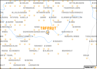
Tafraut (Tiznit, Morocco)Tafraut is a town in the Tiznit region of Morocco. An overview map of the region around Tafraut is displayed below.
regional and 3d topo map of Tafraut, Morocco ::
Tafraut airports ::
The nearest airport is AGA - Agadir Inezgane, located 128.8 km north of Tafraut.
Other airports nearby include TTA - Tan Tan Plage Blanche (147.6 km south west), TIN - Tindouf (249.8 km south east), Nearby towns ::
Uanás (1.9km north) //
Erkount (1.9km north) //
Sidi Borya (2.5km north east) //
Id Hameïda (2.5km north east) //
Id Barca (3.2km east) //
Sidi Mohammed Bel Kassem (3.2km east) //
Taurirt en Diaix (3.2km east) //
Fidud (4.0km north east) //
Id Zarbezan (4.0km north east) //
Id Budar (3.7km north west) //
Imougueni (4.9km south east) //
Tiguidar (4.9km north east) //
Id Embarec (5.6km south) //
Izerban (5.6km south) //
Sidi Messaoud Housseïn (4.8km west) //
Id Nasar (5.8km north) //
Sidi Slimane (5.8km north) //
Id Sidi Abdellah (5.8km south) //
Dahar (5.8km north) //
Zoco el Tenin de Amel-lu (5.2km west) //
Idmeschiren (6.4km north east) //
Id Aachour (6.4km south west) //
Tanimast (6.4km south west) //
Id Hamuad Ali (6.4km north west) //
Id el Belah (7.4km south) //
Id Bekhouch (6.5km east) //
Id U Mart (6.5km west) //
Tahanout Mefort (6.7km west) //
Haïsoum (6.7km west) //
[all distances 'as the bird flies' and approximate] 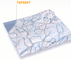 Places with similar names to Tafraut, Morocco ::
Disclaimer :: Information on this page comes without warranty of any kind |
||
|
Where is Tafraut? Elevation and coordinates ::
Latitude (lat): 29°17'0"N Longitude (lon): 9°59'0"W
Elevation (approx.): 582m (map arrows pan, magnifying glasses zoom) |
||
|
Visiting Tafraut? Hotel/Accommodation ::
Book a hotel in Tafraut Travel Guide ::
Buy a travel guide for Morocco rental cars ::
car rental offers GPS waypoint ::
download a GPX waypoint (PoI) of Tafraut for your GPS receiver
|
||