|
search place name
|
||
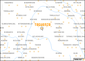
Taguenza (Agadir, Morocco)Taguenza is a town in the Agadir region of Morocco. An overview map of the region around Taguenza is displayed below.
regional and 3d topo map of Taguenza, Morocco ::
Taguenza airports ::
The nearest airport is AGA - Agadir Inezgane, located 56.3 km north west of Taguenza.
Other airports nearby include RAK - Marrakech Menara (210.8 km north east), TTA - Tan Tan Plage Blanche (256.8 km south west), Nearby towns ::
Imi Ouaoul (2.5km north east) //
Aït Yahya (2.5km north west) //
Ilikmiss (4.0km south east) //
Asrharkiss (3.7km north east) //
Aït Lachguer (4.0km south west) //
Amassine Igourramene (4.9km north east) //
Afayane (4.9km north west) //
Aguerd (6.4km east) //
Dar Tiguemmi (6.7km east) //
Tiferhlal (6.7km east) //
Tazeka (7.6km south) //
Aït Brahim (7.6km north) //
Aït Saïd Ou Abella (6.7km west) //
Tamejloujt (7.4km north east) //
Aït Amibel (7.4km south west) //
Tanoumest (7.4km south east) //
Anzad (8.8km south west) //
Tlata Ouanas (10.6km north east) //
[all distances 'as the bird flies' and approximate]  Places with similar names to Taguenza, Morocco ::
Disclaimer :: Information on this page comes without warranty of any kind |
||
|
Where is Taguenza? Elevation and coordinates ::
Latitude (lat): 29°59'0"N Longitude (lon): 9°11'0"W
Elevation (approx.): 1003m (map arrows pan, magnifying glasses zoom) |
||
|
Visiting Taguenza? Hotel/Accommodation ::
Book a hotel in Taguenza Travel Guide ::
Buy a travel guide for Morocco rental cars ::
car rental offers GPS waypoint ::
download a GPX waypoint (PoI) of Taguenza for your GPS receiver
|
||