|
search place name
|
||
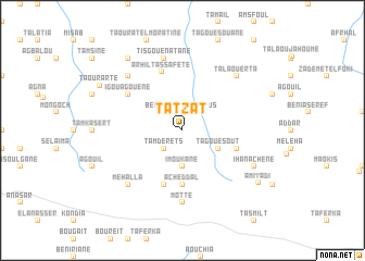
Tatzat (Chaouen, Morocco)Tatzat is a town in the Chaouen region of Morocco. An overview map of the region around Tatzat is displayed below.
regional and 3d topo map of Tatzat, Morocco ::
Tatzat airports ::
The nearest airport is TTU - Tetouan Saniat Rmel, located 71.0 km north west of Tatzat.
Other airports nearby include AHU - Al Hociema Cherif El Idrissi (92.7 km east), TNG - Tanger Ibn Batouta (120.4 km north west), GIB - Gibraltar (126.8 km north), FEZ - Fez Saiss (128.8 km south), Nearby towns ::
Tamderets (2.4km south west) //
Amelaous (2.4km north east) //
Beni Ensar (2.4km north west) //
Imoukane (3.7km south) //
Tagouesout (3.6km south east) //
Acheddal (5.6km south) //
Agbalou (4.9km east) //
Helou (5.8km south) //
Arhil Tassafete (6.2km north) //
Igouagouene (5.9km north west) //
Motte (7.4km south) //
Tisgouenatane (7.6km north) //
Tala Ouerta (7.2km north east) //
Bou Haled (7.2km north west) //
Mehalla (7.2km south west) //
Ihanachene (7.1km south east) //
Azagar (8.7km north west) //
Amiyadi (8.4km south east) //
Taourarte (8.4km north west) //
[all distances 'as the bird flies' and approximate]  Places with similar names to Tatzat, Morocco ::
Disclaimer :: Information on this page comes without warranty of any kind |
||
|
Where is Tatzat? Elevation and coordinates ::
Latitude (lat): 35°5'0"N Longitude (lon): 4°51'0"W
Elevation (approx.): 836m (map arrows pan, magnifying glasses zoom) |
||
|
Visiting Tatzat? Hotel/Accommodation ::
Book a hotel in Tatzat Travel Guide ::
Buy a travel guide for Morocco rental cars ::
car rental offers GPS waypoint ::
download a GPX waypoint (PoI) of Tatzat for your GPS receiver
|
||