|
search place name
|
||
Tazart (Taroudannt, Morocco)Tazart is a town in the Taroudannt region of Morocco. An overview map of the region around Tazart is displayed below.
regional and 3d topo map of Tazart, Morocco ::

Tazart airports ::
The nearest airport is AGA - Agadir Inezgane, located 117.9 km west of Tazart.
Other airports nearby include OZZ - Ouarzazate (163.6 km north east), RAK - Marrakech Menara (164.3 km north), Nearby towns ::
Adar (2.0km west) //
Timguedert (3.2km east) //
Afergal (3.7km north west) //
Agadir Aguenousil (3.7km south east) //
Agouni Ougouram (3.7km south east) //
Talâat Nouamane (4.0km south west) //
Tilioua (4.0km south east) //
Annamer (3.7km south west) //
Aït Mouga (3.7km south west) //
Ouizlane (3.7km north west) //
Tassoult (4.5km north) //
Tig Natine (4.2km south west) //
Amennayo (4.9km south) //
Tamz (4.9km south east) //
Tazarine (4.8km west) //
Imni (4.8km west) //
Tadenst (5.6km north) //
Tiklilt (5.8km north) //
Imiane (5.3km north east) //
Tislafine (6.4km south east) //
Talat (6.1km north east) //
Imni (6.2km south west) //
Inejjarene (7.4km north) //
Zaouia Aït Kourbane (6.5km east) //
Ouine Tataïn (6.7km west) //
Agouni (7.6km north) //
Taourirt (7.6km north) //
Imiri (7.6km north) //
Ifesfes (7.4km south west) //
[all distances 'as the bird flies' and approximate] 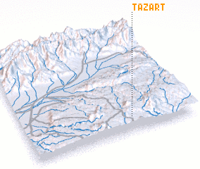 Places with similar names to Tazart, Morocco ::
Disclaimer :: Information on this page comes without warranty of any kind |
||
|
Where is Tazart? Elevation and coordinates ::
Latitude (lat): 30°9'0"N Longitude (lon): 8°21'0"W
Elevation (approx.): 1760m (map arrows pan, magnifying glasses zoom) |
||
|
Visiting Tazart? Hotel/Accommodation ::
Book a hotel in Tazart Travel Guide ::
Buy a travel guide for Morocco rental cars ::
car rental offers GPS waypoint ::
download a GPX waypoint (PoI) of Tazart for your GPS receiver
|
||