|
search place name
|
||
Toulgount (Al Hoceïma, Morocco)Toulgount is a town in the Al Hoceïma region of Morocco. An overview map of the region around Toulgount is displayed below.
regional and 3d topo map of Toulgount, Morocco ::

Toulgount airports ::
The nearest airport is AHU - Al Hociema Cherif El Idrissi, located 82.0 km north east of Toulgount.
Other airports nearby include FEZ - Fez Saiss (101.1 km south), TTU - Tetouan Saniat Rmel (111.3 km north west), MEK - Meknes Bassatine (131.0 km south west), TNG - Tanger Ibn Batouta (159.1 km north west), Nearby towns ::
Taragalla (2.4km south west) //
Aguebal (2.4km north west) //
Al Makhzene (3.7km north) //
Beni Issi (4.8km north east) //
Achorot Mensor (4.8km north west) //
Aït el Hachmi (4.9km east) //
Ljakonene (5.8km north) //
Amgouine (4.9km east) //
Ikkawn (5.9km south west) //
Tasagar (5.9km north west) //
Aït Solimane (6.1km east) //
Tazarine (6.4km east) //
Oulad Abdallah (7.2km south east) //
El Azib (7.2km south east) //
Douar Aïla (7.2km south west) //
Ikaouene (7.1km south west) //
Azib Bou Seri (8.7km south west) //
Igousdarene (8.2km north west) //
Azila (9.6km north east) //
[all distances 'as the bird flies' and approximate] 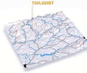 Places with similar names to Toulgount, Morocco ::
// Tilǝkǝnd (AZ)
// Dalqand (IR)
// Del Kandī (IR)
// Delqand (IR)
// Dūl Kandī (IR)
// Deluākāndi (BD)
// Tailkunda (BD)
// Tāluk Kāndi (BD)
// Teligānti (BD)
// Talagante (CL)
Disclaimer :: Information on this page comes without warranty of any kind |
||
|
Where is Toulgount? Elevation and coordinates ::
Latitude (lat): 34°47'0"N Longitude (lon): 4°36'0"W
Elevation (approx.): 832m (map arrows pan, magnifying glasses zoom) |
||
|
Visiting Toulgount? Hotel/Accommodation ::
Book a hotel in Toulgount Travel Guide ::
Buy a travel guide for Morocco rental cars ::
car rental offers GPS waypoint ::
download a GPX waypoint (PoI) of Toulgount for your GPS receiver
|
||