|
search place name
|
||
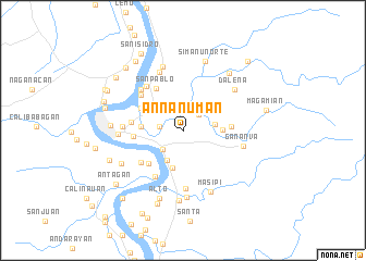
Annanuman (Isabela, Philippines)Annanuman is a town in the Isabela region of Philippines. An overview map of the region around Annanuman is displayed below.
regional and 3d topo map of Annanuman, Philippines ::
Annanuman airports ::
The nearest airport is BAG - Baguio, located 173.3 km south west of Annanuman.
Nearby towns ::
Antagan (2.2km north east) //
Pagappo (2.4km west) //
Bungad (2.4km west) //
Mineqqui (2.6km north east) //
Garita (2.8km south west) //
Pacallo (3.2km east) //
Capsan (3.4km south west) //
Tamsen (3.9km south) //
Caddangan (3.9km east) //
Manga (4.2km west) //
Calamagui (4.2km north west) //
Canogan Abajo Norte (4.8km south west) //
Minanga Norte (4.7km north west) //
Cabannuangan (4.7km east) //
San Pablo (5.0km north west) //
Cubag (4.9km west) //
Catabayungan (5.1km west) //
San Vicente (5.2km south west) //
Tuliao (5.5km south west) //
Binguang (5.6km north west) //
Balasig (5.9km south) //
Auitan (5.8km north west) //
Lattu (5.9km north west) //
Minanga Sur (5.9km west) //
Luquilu (5.9km west) //
Barumbung (5.9km west) //
Bagutari (5.9km west) //
Canzan (5.9km west) //
Baluarte (5.9km west) //
[all distances 'as the bird flies' and approximate]  Places with similar names to Annanuman, Philippines :: Disclaimer :: Information on this page comes without warranty of any kind |
||
|
Where is Annanuman? Elevation and coordinates ::
Latitude (lat): 17°25'44"N Longitude (lon): 121°49'20"E
Elevation (approx.): 36m (map arrows pan, magnifying glasses zoom) |
||
|
Visiting Annanuman? Hotel/Accommodation ::
Book a hotel in Annanuman Travel Guide ::
Buy a travel guide for Philippines rental cars ::
car rental offers GPS waypoint ::
download a GPX waypoint (PoI) of Annanuman for your GPS receiver
|
||