|
search place name
|
||
Baang (Bohol, Philippines)Baang is a town in the Bohol region of Philippines. An overview map of the region around Baang is displayed below.
regional and 3d topo map of Baang, Philippines ::

Baang airports ::
The nearest airport is NOP - Masbate Mactan Cebu Intl, located 56.3 km north of Baang.
Other airports nearby include DGT - Dumaguete (94.0 km south west), BCD - Bacolod (151.2 km north west), CGY - Ladag Cagayan De Oro (166.5 km south east), ILO - Iloilo (190.2 km north west), Nearby towns ::
Ambuan (1.6km west) //
Limbutan (1.9km north) //
Cang Iras (1.9km north) //
Limbutan (2.6km south west) //
Hanopol (2.7km north west) //
Saling (3.2km south west) //
Bayahavan (3.4km south east) //
Hanopol (3.5km east) //
Jaguilanan (3.5km north west) //
Cabainetan (3.7km east) //
Alegria (3.7km north) //
Catagbacan (3.7km west) //
Abuaya (4.1km north east) //
Boctol (4.8km south west) //
Silob (5.6km north) //
Mahayag (5.6km north east) //
Baang (5.9km north) //
Tanla (5.8km east) //
Sagasa (5.8km west) //
Catigbian (5.9km north) //
Hanopol (6.0km south) //
Catigbian (6.0km north) //
Cando (6.0km west) //
Angilan (6.4km north west) //
Agbuaya (6.6km north west) //
Campagao (6.6km south east) //
Balilihan (6.8km south west) //
Tabuan (7.0km west) //
Dorol (7.2km south west) //
[all distances 'as the bird flies' and approximate] 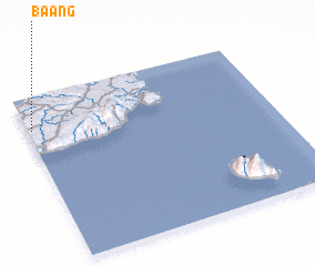 Places with similar names to Baang, Philippines ::
Disclaimer :: Information on this page comes without warranty of any kind |
||
|
Where is Baang? Elevation and coordinates ::
Latitude (lat): 9°48'0"N Longitude (lon): 124°1'0"E
Elevation (approx.): 171m (map arrows pan, magnifying glasses zoom) |
||
|
Visiting Baang? Hotel/Accommodation ::
Book a hotel in Baang Travel Guide ::
Buy a travel guide for Philippines rental cars ::
car rental offers GPS waypoint ::
download a GPX waypoint (PoI) of Baang for your GPS receiver
|
||