|
search place name
|
||
Bailan (Masbate, Philippines)Bailan is a town in the Masbate region of Philippines. An overview map of the region around Bailan is displayed below.
regional and 3d topo map of Bailan, Philippines ::

Bailan airports ::
The nearest airport is KLO - Kalibo, located 159.8 km south west of Bailan.
Other airports nearby include TAC - Tacloban Daniel Z Romualdez (183.4 km south east), BCD - Bacolod (199.1 km south west), ILO - Iloilo (214.2 km south west), NOP - Masbate Mactan Cebu Intl (218.6 km south), Nearby towns ::
Canbacoco (0.0km north) //
Impapanan (1.8km east) //
Amoroy (2.0km north) //
Balatucan (2.3km east) //
Canlaorente (2.6km south east) //
Jintuculan (2.6km north west) //
Marintoc (2.9km north) //
Armenia (3.0km south east) //
Diot (4.1km north west) //
Sagausauan (4.1km north west) //
Paniqui (4.6km south east) //
Umabay (5.0km north west) //
Marsella (5.2km south east) //
Minusuan (5.2km south east) //
Bagacay (5.4km north west) //
Batang (5.4km west) //
Boro Banco (5.4km west) //
Macabug (5.7km north west) //
Sawang (5.7km south east) //
Panal (5.7km west) //
Laguna (5.8km north) //
Salvacion (5.9km north) //
Dacu (6.2km north) //
Mabunga (7.1km north west) //
Tangay (7.6km north) //
Luyong Catungan (8.0km north) //
Dapdap (8.0km south east) //
Pinamalatican (8.0km north west) //
Payao (8.2km west) //
[all distances 'as the bird flies' and approximate] 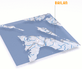 Places with similar names to Bailan, Philippines ::
Disclaimer :: Information on this page comes without warranty of any kind |
||
|
Where is Bailan? Elevation and coordinates ::
Latitude (lat): 12°16'0"N Longitude (lon): 123°43'0"E
Elevation (approx.): 209m (map arrows pan, magnifying glasses zoom) |
||
|
Visiting Bailan? Hotel/Accommodation ::
Book a hotel in Bailan Travel Guide ::
Buy a travel guide for Philippines rental cars ::
car rental offers GPS waypoint ::
download a GPX waypoint (PoI) of Bailan for your GPS receiver
|
||