|
search place name
|
||
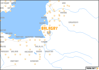
Balagay (Lanao del Sur, Philippines)Balagay is a town in the Lanao del Sur region of Philippines. An overview map of the region around Balagay is displayed below.
regional and 3d topo map of Balagay, Philippines ::
Balagay airports ::
The nearest airport is CEB - Cebu Cotabato, located 71.5 km south of Balagay.
Other airports nearby include CGY - Ladag Cagayan De Oro (74.7 km north east), LGP - Legazpi Pagadian (96.6 km west), DGT - Dumaguete (204.2 km north west), Nearby towns ::
Tucasan (0.0km north) //
Kukar (0.0km north) //
Masiu (1.3km north) //
Sawir (1.6km west) //
Pantao (1.9km north) //
Mimbalay (1.9km north) //
Dagawan (1.9km north) //
Pangarapan (1.9km north) //
Putad (2.4km north west) //
Talaguian (2.4km north east) //
Talub (2.6km north west) //
Balaygay (2.6km south west) //
Yalamay (2.6km south west) //
Tapurug (3.7km north) //
Ragayan (3.7km north) //
Buadi-Amaloy (3.7km north) //
Putad (3.7km north) //
Cairon (3.7km north) //
Kakar (3.7km north) //
Lumbak-a-Ingud (3.7km north) //
Timbab (4.1km south west) //
Bu-isan (4.1km north west) //
Dayawan (4.1km north west) //
Nanagun (4.1km south west) //
Senon (4.2km north west) //
Rugan (5.2km north) //
Kadayonan (5.2km north east) //
Lumbac (5.2km north east) //
Bansayan (5.2km north east) //
[all distances 'as the bird flies' and approximate]  Places with similar names to Balagay, Philippines ::
Disclaimer :: Information on this page comes without warranty of any kind |
||
|
Where is Balagay? Elevation and coordinates ::
Latitude (lat): 7°48'0"N Longitude (lon): 124°20'0"E
Elevation (approx.): 703m (map arrows pan, magnifying glasses zoom) |
||
|
Visiting Balagay? Hotel/Accommodation ::
Book a hotel in Balagay Travel Guide ::
Buy a travel guide for Philippines rental cars ::
car rental offers GPS waypoint ::
download a GPX waypoint (PoI) of Balagay for your GPS receiver
|
||