|
search place name
|
||
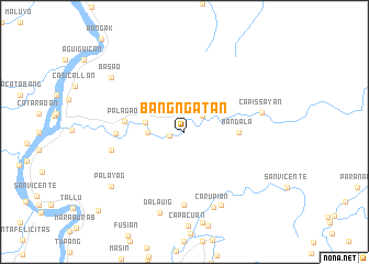
Bangñgatan (Cagayan, Philippines)Bangñgatan is a town in the Cagayan region of Philippines. An overview map of the region around Bangñgatan is displayed below.
regional and 3d topo map of Bangñgatan, Philippines ::
Bangñgatan airports ::
The nearest airport is BAG - Baguio, located 219.4 km south west of Bangñgatan.
Nearby towns ::
Lawog (1.4km west) //
Cumao (2.4km north east) //
Cattanamman (3.5km west) //
Calaogan (3.9km west) //
Bandala (5.3km east) //
Palagao (5.9km west) //
Dummun (6.7km west) //
Bunugan (7.4km south) //
Namook (7.3km west) //
Capissayan (7.7km east) //
Carupian (8.2km south) //
Cappuian (8.2km south east) //
Dalauig (8.6km south) //
Palayag (9.0km south west) //
Basao (9.0km north west) //
Piggatan (11.6km south west) //
[all distances 'as the bird flies' and approximate] 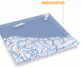 Places with similar names to Bangñgatan, Philippines ::
// Ban Kaeng Ton (TH)
// Ban Kaeng Ton (TH)
// Ban Kaeng Ton (TH)
// Ban Kong Din (TH)
// Ban Kèngdôn (LA)
// Ban Koangtôn (LA)
// Bangangdian (CN)
Disclaimer :: Information on this page comes without warranty of any kind |
||
|
Where is Bangñgatan? Elevation and coordinates ::
Latitude (lat): 18°2'0"N Longitude (lon): 121°45'0"E
Elevation (approx.): 17m (map arrows pan, magnifying glasses zoom) |
||
|
Visiting Bangñgatan? Hotel/Accommodation ::
Book a hotel in Bangñgatan Travel Guide ::
Buy a travel guide for Philippines rental cars ::
car rental offers GPS waypoint ::
download a GPX waypoint (PoI) of Bangñgatan for your GPS receiver
|
||