|
search place name
|
||
Batatic (Cebu, Philippines)Batatic is a town in the Cebu region of Philippines. An overview map of the region around Batatic is displayed below.
regional and 3d topo map of Batatic, Philippines ::

Batatic airports ::
The nearest airport is DGT - Dumaguete, located 59.3 km south west of Batatic.
Other airports nearby include NOP - Masbate Mactan Cebu Intl (72.7 km north east), BCD - Bacolod (113.7 km north west), ILO - Iloilo (147.8 km north west), CGY - Ladag Cagayan De Oro (194.2 km south east), Nearby towns ::
Kasay (1.0km north east) //
Balanigan (1.3km south west) //
Panas (1.7km south east) //
Kawayan (1.8km south west) //
Coro (2.8km south) //
Lanao (3.2km south west) //
Botong (4.4km south west) //
Saksak (4.7km south west) //
Tapon (4.9km south) //
Hernandez (4.9km north east) //
Mandalosa (4.9km west) //
Talaga (5.0km north east) //
Malones (5.1km north west) //
Maloray (5.3km south) //
Biasong (5.3km south) //
Caliongan (5.3km south) //
Panokdokan (5.3km south) //
Tuba (5.3km south) //
Caratagan (5.3km south) //
Kangwaling (5.3km south) //
Panas (5.3km south) //
Dalaguete (5.8km south) //
Tubod (5.9km south west) //
Cansiguin (6.2km north west) //
Bogo (6.3km north east) //
Anajao (6.5km north east) //
Tiguib (6.5km north east) //
Mag-alambac (6.6km west) //
Babayongan (6.9km west) //
[all distances 'as the bird flies' and approximate] 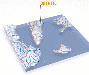 Places with similar names to Batatic, Philippines ::
Disclaimer :: Information on this page comes without warranty of any kind |
||
|
Where is Batatic? Elevation and coordinates ::
Latitude (lat): 9°48'48"N Longitude (lon): 123°32'32"E
Elevation (approx.): 19m (map arrows pan, magnifying glasses zoom) |
||
|
Visiting Batatic? Hotel/Accommodation ::
Book a hotel in Batatic Travel Guide ::
Buy a travel guide for Philippines rental cars ::
car rental offers GPS waypoint ::
download a GPX waypoint (PoI) of Batatic for your GPS receiver
|
||